
Safeguarding Communities with Real-Time Flood Monitoring in the City of Hazelwood
The City of Hazelwood is a suburb in St. Louis County, Missouri, home to around 25,500 people. Recently, the community has suffered increased flash flooding following severe storms, prompting the need for the installation of a flood monitoring system.
In 2022, a NexSens X2 data logger was installed to monitor water level and rainfall in real-time, with the aim of reducing the loss of life and property as a result of extreme weather events.
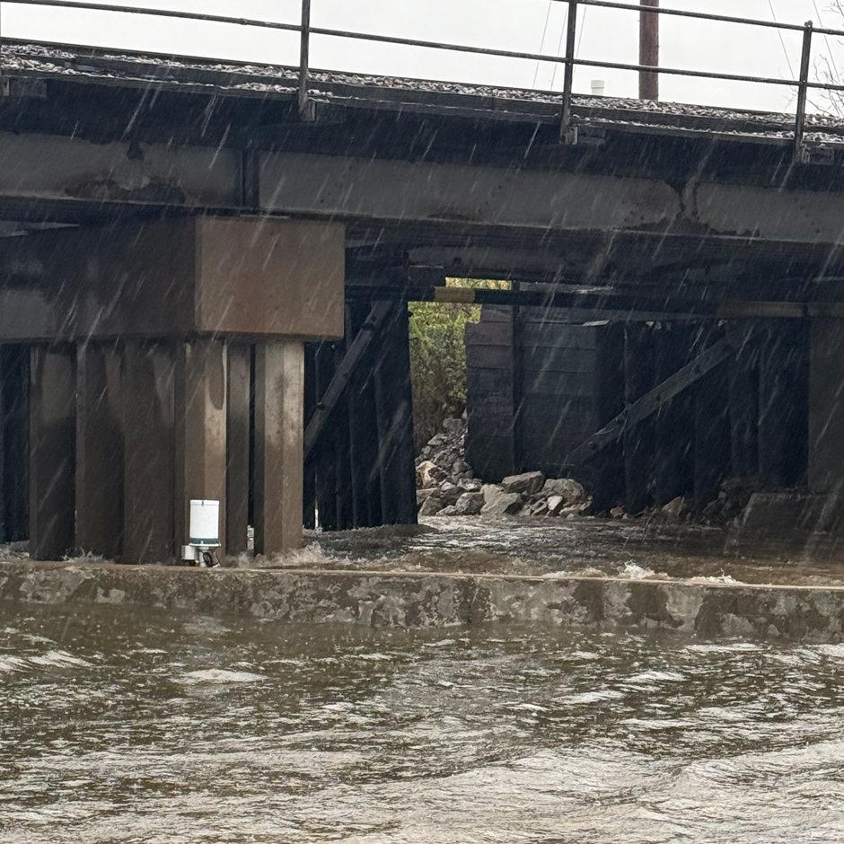
The latest flood event at Coldwater Creek, where the water level rose by 14 feet, exceeding the height of the X2 by three feet. The sensor can be seen behind the wall that usually contains the Creek. (Credit: Gerard Hagedorn / Hazelwood Fire Department)
Flooding in the City of Hazelwood
Coldwater Creek is a tributary of the Missouri River that runs through the eastern part of Hazelwood. It was contaminated with nuclear waste during the Second World War–downtown St. Louis played an important role in refining uranium for the Manhattan Project–and remediation work by the Army Corps of Engineers is still ongoing.
In late July 2022, the St. Louis area was hammered by several rounds of thunderstorms. Rainfall rates exceeded two inches an hour, and Coldwater Creek burst its banks, contributing to record-breaking flooding that left some areas of the city submerged under seven feet of water.
Gerard Hagedorn is a Battalion Chief at the Hazelwood Fire Department, and he also serves as the Deputy Director of Emergency Management for the City of Hazelwood.
Hagedorn describes how, during the 2022 floods, the team “helped evacuate over 150 residents,” with some still “seeking help from FEMA [Federal Emergency Management Agency] for a buyout program.”
This event, which caused millions of dollars of damage, was the catalyst that “sparked the idea of getting flood sensors to monitor the Creek during rain events.”
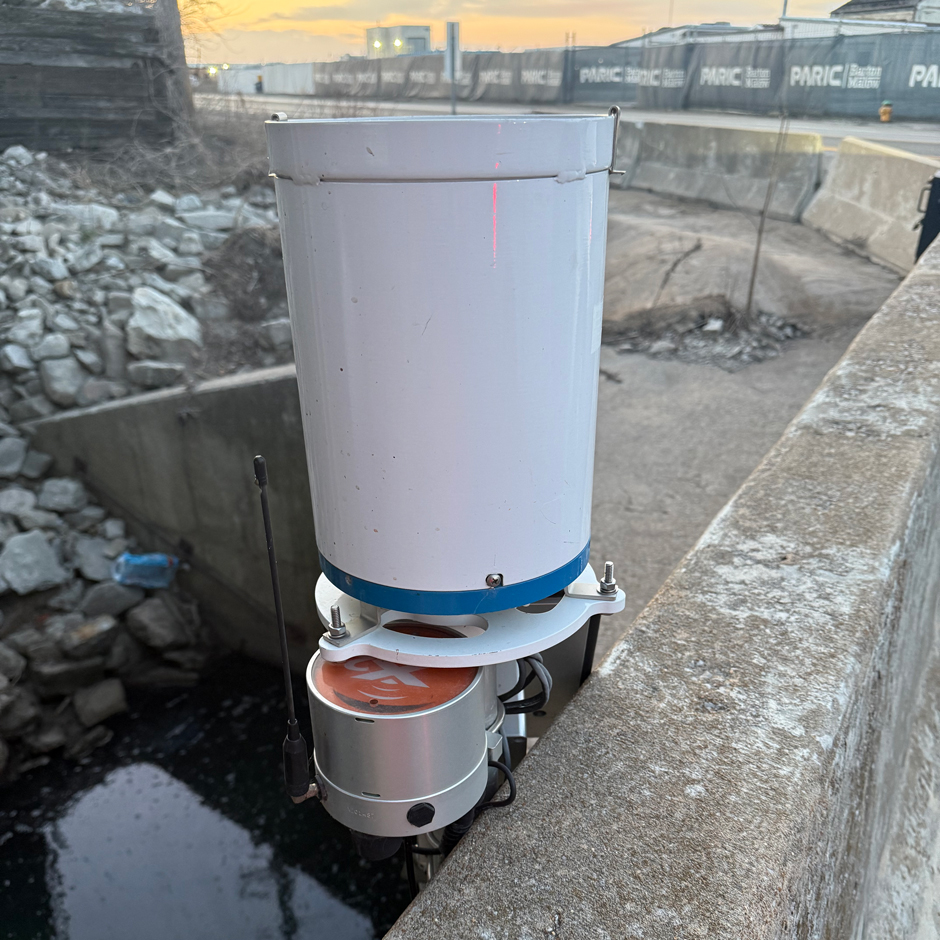
The location of the X2 sensor above Coldwater Creek. The system provides the emergency management team with real-time alerts when the water level begins to rise. (Credit: Gerard Hagedorn / Hazelwood Fire Department)
Transitioning to Real-Time Flood Monitoring
In 2022, the City of Hazelwood installed an X2 data logger and VEGA VEGAPULS C 23 Radar Water Level Sensor, which measures the distance from the water surface to the sensor.
Hagedorn explains, “We chose this sensor because it had everything we wanted–real-time data and alert notifications.”
Installed strategically where the Creek passes St. Louis Lambert International Airport and enters the City of Hazelwood district, Hagedorn highlights, “We decided to put this sensor at that location so that we could judge the amount of water that will come downstream.”
During normal conditions, the sensor sits 11 feet above the water level. When the water level rises, alerts are transmitted to the City of Hazelwood emergency management team using cellular data.
Hagedorn explains, “All of our alerts are to notify us at different benchmarks, so we have a good handle on the conditions of what Coldwater Creek is doing during rain events.”
The first alert is for a two-foot rise in water level. “The next alert is five feet from the bank,” he says.
“This was chosen so we can make the decision on issuing evacuation orders–same with the three-feet from bank alert. At this level, the creek will overflow downstream, which impacts our Civic Center East,” Hagedorn continues.
“We have set this email alert to notify businesses located on the bank of the creek so that they can make the decision to set up their temporary flood walls or to evacuate the area,” he adds.
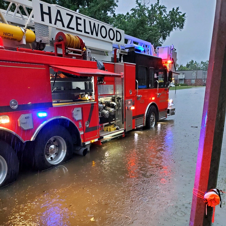
The Hazelwood Fire Department’s ladder truck stands in Coldwater Creek flood waters during the 2022 flood event. At the time of photographing, the crew were evacuating residents from their flooded apartments. (Credit: Gerard Hagedorn / Hazelwood Fire Department)
Changing Emergency Planning
The real-time alerts have transformed flood monitoring in the City of Hazelwood.
Hagedorn states, “Prior to this sensor, we would have to put eyes on the Creek to see what it’s doing. Now we have data that helps us make better-informed decisions on how we respond to the event.”
Furthermore, data from the X2 is unexpectedly shedding light on the flow dynamics of Coldwater Creek, contributing to a better overall understanding of how the Creek responds during extreme events.
The emergency planning team was surprised to find how fast the level rises “once the water hits the two-foot alert […] and how fast the water will recede. Once the rain slows down or stops, the creek will recede at about a foot every 20 minutes,” Hagedorn says.
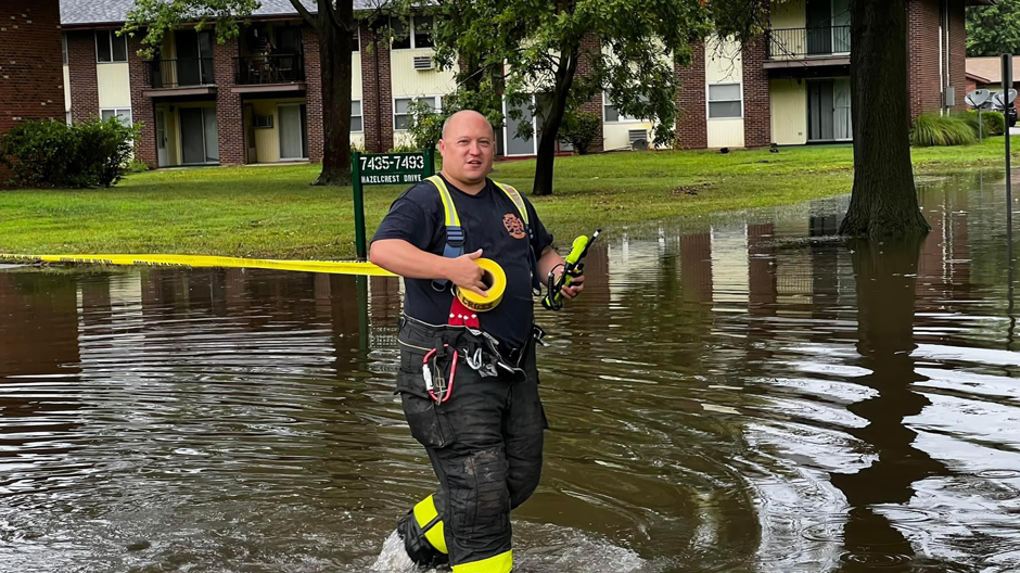
Battalion Chief Leichenauer of the Hazelwood Fire Department walks through flood waters as he cordons off an apartment complex affected by flooding from Coldwater Creek in 2022. (Credit: Gerard Hagedorn / Hazelwood Fire Department)
The Future of Flood Monitoring
Hagedorn observes that flooding of Coldwater Creek has become more frequent in the last five years.
Real-time monitoring has already played an important role in helping to “reduce the loss of life and reduce the effects of flash flooding” and enabling the City of Hazelwood to prepare for emergency events in a timely and proportionate way.
Hagedorn explains, “Our goal is to install more sensors along the Creek, and partner with the National Weather Service of St. Louis so that we can collect more information to make our community more resilient to flash flooding.”
Looking to the future, real-time monitoring systems like this one are likely to become even more important as climate change alters the frequency and intensity of extreme weather events.
The United States Environmental Protection Agency has reported a substantial increase in extreme, single-day precipitation events in the US since the 1980s, with nine of the top 10 extreme one-day precipitation years occurring since 1995.
The X2 logger is just one component of the City of Hazelwood’s emergency planning that is enabling them to take a more “proactive” approach, working holistically to consider early warning systems and flood management strategies that protect residents, business owners, and wider stakeholders.


0 comments