New satellite mapping tools measure carbon capture in coastal marshes
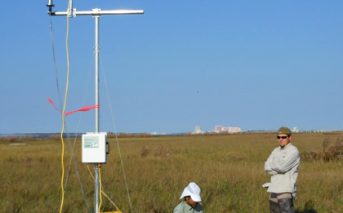
A researcher at the University of Georgia has developed instruments and technology to use satellite measurements in modeling carbon capture in coastal salt marshes, according to a release. The tools were developed with support from NASA. Much of the modeling will rely on data from NASA’s MODIS satellite and will look to measure the carbon … Continue reading New satellite mapping tools measure carbon capture in coastal marshes
0 Comments