Posts for tag "flood"
Flood Chasers Monitor Water Quality in a New Way
A team of flood chasers are monitoring water quality in an Australian estuary, and putting new automated tools to work in the process.
- Posted March 27, 2018
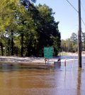
Hurricane Matthew Pushes North Carolina Streamgage Records
Streamgages in parts of North Carolina captured new records thanks to weather systems associated with Hurricane Matthew in October 2016.
- Posted October 17, 2016
Recording High-Water Marks Depends On GPS Data, Elevation
The U.S. Geological Survey establishes high-water marks after floods using GPS data cross-referenced with existing elevation measurements.
- Posted October 7, 2016
Water Level Sensors Show Promise Of New Haven Rain Gardens
Yale University investigators track New Haven rain gardens with water level sensors, showing their usefulness in reducing flow to combined sewer overflows.
- Posted September 6, 2016
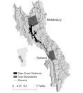
Wetlands Give $450,000 Worth Of Annual Flood Protection To Vermont Town
Investigators at University of Vermont have estimated the monetary value of annual flood protection provided by wetlands along Otter Creek.
- Posted August 10, 2016
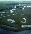
Wetland Restoration Could Be Key To Midwestern Flood Management
Once a common part of the Midwestern landscape, wetlands have been decimated as farmlands and cities have taken over and populations have increased. The losses have left the Midwest more vulnerable to flooding, a problem likely to...
- Posted April 6, 2016
Greenhouse Gases Increase Blamed For Southern England Storms
The 2013-2014 winter was unusually severe in southern England, impacting areas such as Somerset, Dorset, Devon, Cornwall and the Thames Valley. Huge storms passed over, causing unusual flooding and several deaths. According to a release from Oxford...
- Posted February 15, 2016
Australian Floods Worsened By Warming Ocean
During the summer of 2010 to 2011, the Australian state of Queensland experienced severe flooding events despite the fact that the cyclone season was considered normal. In a release, researchers at Woods Hole Oceanographic Institution indicate that...
- Posted December 2, 2015
High 2014 Waters Meant Flooded Sites, Records For Minnehaha Creek Watershed
After the wettest half-year ever, crews at Minnehaha Creek Watershed District worked through summer 2014’s high waters to gather data and inform the public.
- Posted September 17, 2015
U.S. Coastal Cities’ Compound Flooding Risk Increasing
A new study shows that combined flooding risk for U.S. coastal cities is on the rise, according to a Wired article. Combined flooding occurs when heavy rainfall and storm-fueled sea level rise happen at the same time....
- Posted August 4, 2015
Storm Surge, High Precipitation Tied To U.S. Coastal Flooding Vulnerability
High rainfall, storm surge and global sea level rise have all combined to make U.S. coastal cities vulnerable to flooding, according to a recent press release from the University of South Florida. The result of an increase...
- Posted August 3, 2015
Study: Midwestern Flood Potential Calculations Underestimate Risk
Estimating flood risk is important for future disaster planning and floodplain management. Despite that, researchers at Washington University in St. Louis have found that federal agency estimates of midwestern flooding are often as much as five feet...
- Posted July 15, 2015
Expanding cities to face more flood and drought risks
A new study indicates that growing cities face increased exposure to flooding or drought-even without climate change, according to a release from Texas A&M University. Baltimore, Houston and Miami face exposure to floods as the cities expand...
- Posted March 12, 2015
Channel shape, water flows need considered for accurate flood hazard risk assessments
Scientists accounting for channel shape in flood hazard assessments find that geomorphology has a big effect on flood risk over time.
- Posted February 3, 2015


