Posts for tag "soil"
IL Nutrient Loss Reduction Strategy Fostering Cooperation, Improving Water Quality
The IL Nutrient Loss Reduction Strategy is generating interest and improving water quality by reducing nutrient runoff into Illinois watersheds.
- Posted July 27, 2018
Soil Moisture Meter Network Has Nothing On SMAP Satellite
Showing the SMAP satellite’s reach bests the typical soil moisture meter, Iowa Flood Center scientists help to validate and calibrate its measurements.
- Posted September 8, 2016
Managing Soil Erosion Important Around Construction Sites
Experts at Scott Thorne Environmental Consulting track soil erosion with a Hach 2100Q turbidity meter around California construction sites.
- Posted July 29, 2016
Irrigation Schedulers, Soil Moisture Sensors Outpace Older Farming Methods
Farmers have all sorts of old-fashioned methods for assessing the moisture of soil. From just visually inspecting crops to judging moisture based on how deeply a shovel can penetrate, farmers have found ways to get by. More...
- Posted July 12, 2016
Wildfires Cause Surges In Erosion Rates On Forested Mountains
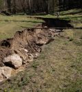
Researchers from the University of Arizona did before-and-after studies of how severe wildfires affect erosion rates.
- Posted May 31, 2016
Soil, Water Contamination In North Dakota From Fracking Spills
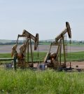
Duke University scientists find water and soil contamination caused by wastewater spills from hydraulic fracturing in the Bakken region of North Dakota.
- Posted May 12, 2016
At Mount Rushmore, Fireworks Have Affected Water And Soil
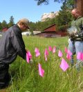
Scientists at the U.S. Geological Survey find that fireworks released around Mount Rushmore have added to perchlorate levels in water and soil there.
- Posted May 6, 2016
Desert Mangroves Make Surprisingly Good Carbon Sinks
Using core samples, mass spectrometry and other techniques, researchers explore the extraordinary carbon sink capacity of desert mangroves.
- Posted April 12, 2016
Lake Ladoga Still Suffers High Radiation Levels From 1950s Nuclear Tests
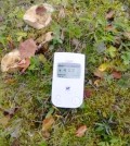
It’s hard for Russia’s Lake Ladoga to escape its history as a test site for Soviet-era nukes. This is evident by a number of surveys that have sampled soils on islands around the lake since the testing...
- Posted April 1, 2016
Soil Microbes Less Adaptable To Climate Change Than Previously Thought
A 17-year study of soil microbes transplanted at different elevations finds little change, pointing to reduced adaptability in a climate change future.
- Posted March 29, 2016
Metropolitan Carbon Dioxide Emissions Come From Gardens, Landscaping
Using a LI-COR soil efflux system and other gear, Boston University scientists find gardens and landscaping add to metropolitan carbon dioxide emissions.
- Posted March 8, 2016
Soil Microbes Hit By Climate Change Need More Study
While it’s clear that climate change is affecting many plants and animals, it’s not yet clear how some other parts of ecosystems are influenced, such as microbial communities in soil. Healthy ecosystems are dependent on soil microbes...
- Posted December 21, 2015
USGS Scientists Chart Climatic Timeline Of Las Vegas Desert Wetlands, Springs
U.S. Geological Survey scientists use sediment cores, geographic methods and GPS technology to construct a narrative of ancient desert wetland wildlife at a Las Vegas study site.
- Posted December 1, 2015
New Findings Encourage Soil-Carbon Modeling Update
Researchers at Cornell University and Oregon State University are calling for updated soil-carbon modeling techniques, according to a release from Cornell. They say that new methods are needed in light of new findings and changes to the...
- Posted November 30, 2015
USGS Scientists Create Models To Predict Soil Erosion Risk After Wildfires
A synthesis of GIS soil erosion models and future fire-risk models yields projections of post-wildfire erosion risks for western U.S. watersheds.
- Posted November 23, 2015
Swedish Lake Sediments Reveal Last Ice Age’s End
Ancient remains of midges in Swedish lake sediments, moisture-sensitive sediment molecules and climate modeling results combine to suggest that the melting of the Scandinavian Ice Sheet about 13,000 years ago was the culprit for the reversal in...
- Posted November 23, 2015
Southeast Missouri State Installs Soil Sensors For Students, Farmers
A soil sensor system installed at Southeast Missouri State University will provide data for students to study while helping farmers too.
- Posted October 13, 2015
Middle East Sediment Cores Show Downfall Of Empires Linked To Drought
A study of sediment cores taken near the Tigris and Euphrates Rivers reveals drought periods coincide with major transitions between ruling empires.
- Posted October 6, 2015
USDA Scientists Measure CO2 In Soil
Using CO2 sensors, infrared gas analyzers, canopy chambers and a Bowen ratio apparatus, USDA researchers explore soil CO2 and its implications for surface dwellers.
- Posted September 18, 2015
University Of California Riverside Takes Measures To Heal Iconic Oak Tree
To help heal an iconic oak tree on campus, experts at University of California, Riverside, have loosened soil around roots and put in soil sensors.
- Posted September 15, 2015


