Posts for tag "streamflow"
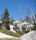
Vegetation Type Has Role In Future Sierra Nevada Stream Flows
Researchers at University of California, Santa Barbara, find changes in vegetation type due to climate warming will impact Sierra Nevada stream flows.
- Posted September 23, 2016
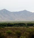
San Pedro River Seeing Streamflow, Groundwater Declines
Streamflow and groundwater feeding Arizona’s San Pedro River are declining in some locations, according to U.S. Geological Survey researchers.
- Posted September 22, 2016
Groundwater Age Foretells Colorado River Drought Vulnerability
Scientists with the U.S. Geological Survey find that groundwater age is a key factor in gauging the Upper Colorado River Basin’s future drought resilience.
- Posted September 19, 2016
Underground Water Flow Prediction Models Improving
Researchers at Missouri University of Science and Technology are working to improve predictions of underground water flow, according to a release. Their efforts are aimed at making predictions better despite porous terrain or the existence of channels...
- Posted June 16, 2016
Park Service Assesses Health Of Pennsylvania Headwater Streams Of Chesapeake Bay
In the Pennsylvania headwater streams of Chesapeake Bay, National Park Service officials track water level and temperature to assess aquatic health.
- Posted May 17, 2016
Understanding Stream Dynamics By Supplementing Stream Gages
U.S. Geological Survey scientists track changing stream dynamics in Arizona, often on short notice after natural disasters, to improve stream flow data.
- Posted May 16, 2016
Cloud Computing Could Aid River Restoration Projects
In the past, engineered rivers have been designed mostly to control flood waters. But nowadays, people have started to see the values rivers convey for recreation, biodiversity and ecological services. Those have in part helped to spur...
- Posted March 17, 2016
Southwestern Kansas Streamflows Down Since 1950s
Streamflows in southwestern Kansas are down since the 1950s, according to a release from the U.S. Geological Survey. Officials from the agency say that the most likely causes are groundwater withdrawals that have drawn down levels of...
- Posted February 4, 2016
USGS Streamflow Gages Track Ever-Changing Nature Of Nation’s Rivers
Using ADCPs and streamflow gages, USGS scientists monitor flooding, drought and everything in between for rivers in Ohio and elsewhere.
- Posted December 22, 2015
New Streamflow Prediction Technique Produces Highly Accurate Forecasts
Otowi River stream gage data’s remarkable correlation with the Pacific Decadal Oscillation is informing the most accurate streamflow forecasts ever seen.
- Posted October 28, 2015
USGS Hydrologists Respond to Utah’s Hildale Flood
Hydrologist Cory Angeroth oversees Utah’s streamgage network and was involved in the U.S. Geological Survey’s response to a flash flood in Hildale, Utah.
- Posted October 12, 2015
Data From Western Streams Will Aid Understanding Of Drought Vulnerability
Scientists with the U.S. Geological Survey are gathering data on streams in Idaho and five other western states to assess drought vulnerability.
- Posted September 21, 2015
High 2014 Waters Meant Flooded Sites, Records For Minnehaha Creek Watershed
After the wettest half-year ever, crews at Minnehaha Creek Watershed District worked through summer 2014’s high waters to gather data and inform the public.
- Posted September 17, 2015
USGS Intermittent Streams Study Finds Correlation Between Climate, Flow Regime
A new USGS study analyzing the effects of climate variability on intermittent streams finds their flow regimes closely reflect historical climate patterns.
- Posted August 21, 2015
Seismic Sensors Inform New Measurement Method For Glacial Flows
Unlike with landlocked glaciers that have meltwater rivers scientists can study, measuring flows from tidewater glaciers near the sea is much harder, according to a release from the University of Texas. But it is possible, thanks to...
- Posted August 12, 2015
New Method Helps Measure Water’s Preferential Flow Through Soil
Measuring water’s preferential flow has long challenged scientists because of its unpredictability and the things that can influence it, like soil. A team of scientists led by Pennsylvania State University’s Henry Lin developed a method to measure...
- Posted May 15, 2015
Salt River Project manager develops “flowtography” discharge measurements
An employee with the Salt River Project has developed what is being called “flowtography,” according to the Verde Independent. The method is an inexpensive way to monitor stream flow by combining time-lapse cameras with data from in-stream...
- Posted February 25, 2015
Pennsylvania streamflow estimator delivers years of data on ungauged streams
A new Pennsylvania streamflow estimating tool gives 40 years of daily data for ungauged streams.
- Posted March 8, 2013


