‘Unexplained paradox’ explained: Why flashy desert channels look the way they do

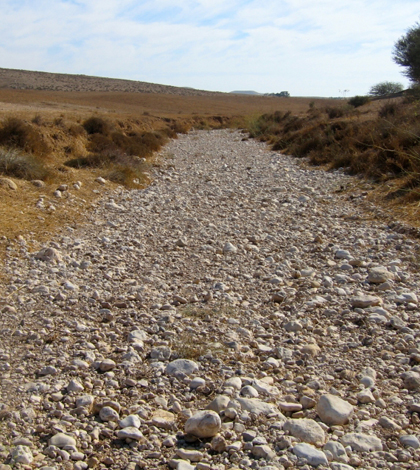
The Rambla de Nogalte in Spain is an ephemeral stream with simple, straight topography. (Credit: Katerina Michaelides)
Stream channels in desert landscapes can lay bone-dry for weeks or months at a time before an erratic, volatile storm suddenly turns a reach into a raging torrent. But when the water recedes, the channel often looks like not much happened, with no sign of structures like point bars, cut banks, riffles and pools that one might expect to see if a stream with perennial flow suddenly lost its water.
For scientists who study these landscapes, that’s the “unexplained paradox”: Despite having the occasional hydraulics seemingly capable of building some complex streambed topography, desert channels tend to remain simple, smooth and straight. A new study published in the journal Geology is the first to explain what’s going on.
The effect is partially a result of the size of the storms that drive flows in dry channels. They’re rarely as large as the whole river basin, and the smaller storms can lead to flow in one segment of the channel while it remains dry upstream. Rain in the mountains can also trigger flows from the headwaters, but those flows diminish as the water is absorbed by the parched channel.
“You start losing water as you move downstream,” said Michael Singer, study author and lecturer at the University of St. Andrews’ Department of Earth & Environmental Sciences. “And eventually the water just stops.”

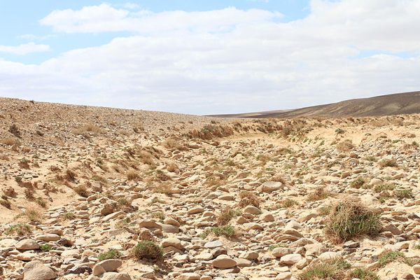
Intermittently dry channels, like this one in Jordan, have simple, symmetrical structure. (Credit: AinAnepaio, via Wikimedia Commons/CC BY-SA 3.0)
Any one storm appears to have the power to build some structure into the channel, eroding some sediment here and depositing it there. But the net effect of multiple patchy storms causing such variable flow configurations appears to be that what one storm builds, another destroys.
“All of those different storms will end up canceling each other out,” Singer said.
And for good measure, the results of the study suggest that a large storm that covers whole basin and fills the tributaries can also reset the system, smoothing out any topography built by previous flows.

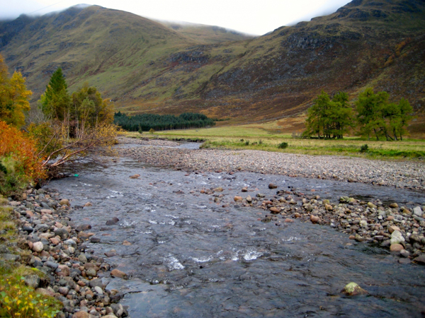
Rivers with year-round flows have more copmlex structure like points, bars and pools. (Credit: Michael Singer)
The study is based on data collected from the Rambla de Nogalte, an ephemeral stream in southeastern Spain. Study co-author Katerina Michaelides measured the topography acros 29 cross sections. She characterized the grain size of the channel’s sediment by measuring the dimensions of hundreds of pebbles. Singer fed those data, along with information on runoff for the area, into models that simulate how various flows will move sediment of various coarseness.
The study helps resolve long-unanswered questions about how desert landscapes work and change. A better understanding of these systems could help managers in arid regions predict when or whether runoff might reach a reservoir or how sediment could impact structures like bridges. Knowing how the streams work will also make it easier to project how they’ll change with the climate, especially as water scarcity grows and the storms that drive the action become more or less frequent and intense.
“If you know how climate change is expected to change ephemeral river channels, you can also anticipate how that might impact flash flood frequency and the speed with which those flood waves pass through,” Singer said.
Top image: The Rambla de Nogalte in Spain is an ephemeral stream with simple, straight topography. (Credit: Katerina Michaelides)


0 comments