Cal Poly, San Luis Obispo Manages Monitoring Efforts in Morro Bay
California Polytechnic State University, San Luis Obispo (Cal Poly, SLO), has been monitoring Morro Bay for decades, and while the monitoring program has changed over the years, the dedication to monitoring the bay has remained the same.
The project started in 2006 as a Packard Foundation-funded initiative to monitor water quality flowing in and out of Morro Bay. The goal at the time was to use the data collected to develop and inform an ecosystem-based management plan in collaboration with the Morro Bay National Estuary Program (MBNEP).
Since the estuary was the focus at the time, researchers were monitoring water flowing into the estuary from Chorro Creek and Los Osos Creek. Two stationary monitoring systems were installed in each creek, and temperature and salinity, as well as nutrient and sediment loads, were recorded to monitor the influx and efflux of contaminants in the estuary.
Eventually, a station at the southern end of the bay, referred to as Bay South 1 (BS1), was created to observe the impact of groundwater nutrient inputs from the town of Los Osos. A fourth station near the mouth of the estuary, appropriately named Bay Mouth 1 (BM1), was also added to the project to monitor the oceanic inputs.
In 2011, funding for the project concluded, which required the removal of the creek stations to continue focusing on monitoring of the bay. As Cal Poly, SLO continued to look for funding to maintain the monitoring infrastructure, BS1 was closed, and BM1 was the only monitoring station left to look at what was coming in and out of the estuary.
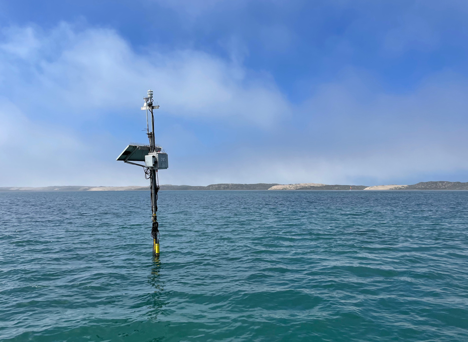
BS1 sampling platform in its deployed position. The site is powered by a solar-powered battery, connects to the WQDataLive cloud service with a cellular modem, and collects temperature, salinity, oxygen, chlorophyll, turbidity, pH, and weather parameters. The site is located between two oyster aquaculture facilities in Morro Bay, CA. (Credit: Ian Robbins / Cal Poly, SLO)
Restarting the Morro Bay Monitoring Program
Eventually, they were integrated into a shore station monitoring program managed by NOAA under their Integrated Ocean Observing System (IOOS). Around 2012, Cal Poly received funding through the Central & Northern California Ocean Observing System (CeNCOOS) to keep the BM1 site running.
Around the same time, two shellfish aquaculture facilities in the southern bay became interested in the project because of their awareness of how much the water quality of the bay can change and how sensitive shellfish can be to these changes. Additionally, the Department of Public Health was interested in monitoring water temperatures in the bay due to the relationship between bacteria and temperature.
These interests from stakeholders, coupled with the overall dedication of MBNEP and Cal Poly, SLO to maintain a long-term dataset at multiple sites in the estuary, provided a mechanism to leverage more funding from CeNCOOS and reopen the BS1 site in 2018.
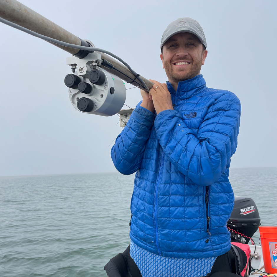
Dr. Ryan Walter holds the top-side pole at BS1, preparing to connect the Seabird HydroCAT, SeaFET, and Gill weather station to the NexSens datalogger for the initial deployment. (Credit: Ian Robbins / Cal Poly, SLO)
As an additional bonus, from 2020-2023, MBNEP and CeNCOOS both benefited from federal infrastructure funding and were able to provide funding to update the older and outdated electronics on the water quality monitoring stations to newer models. Both BS1 and BM1 were upgraded with a Sea-bird HydroCAT, SeaFET sensor, and NexSens data logger. BS1 was also equipped with a Gill weather station.
“NexSens became one of the only platforms that we could find that was an all-inclusive data integration platform, data transmission platform, and data viewing, platform, that allowed us to hook all of our instruments in and be able to display and look at and download that data,” recalls Ian Robbins, Senior Research Scientist.
The HydroCAT monitors salinity, temperature, pressure/depth, oxygen, backscatter, and chlorophyll; and the SeaFET sensor measures pH.
One of the greatest challenges to instrumenting these stations was finding equipment that could withstand the elements of the bay. Since the stations are in relatively shallow parts of the bay, a non-submersible logger positioned high above the waterline helps protect the instruments and cables from corrosion. At the same time, the sensors can be deployed right in the water, ensuring they stay wet throughout the deployment.
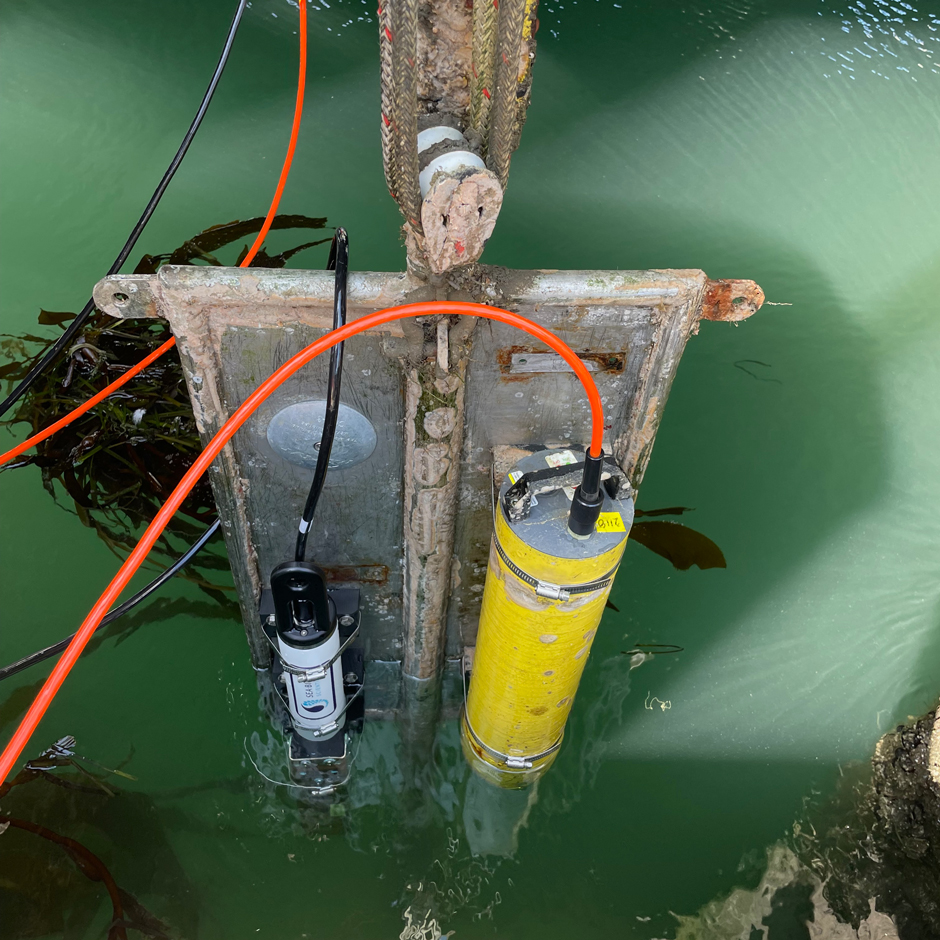
View of instrument plate at BM1 being prepared to lower into its fixed position. The plate is positioned 2 meters below the MLLW line and can be raised and lowered with a block and tackle system. (Credit: Ian Robbins / Cal Poly, SLO)
Conclusion
Though the estuary has changed substantially over the years, monitoring efforts in the bay have continued. One example Robbins shares is the sudden loss and then regrowth of eelgrass, which is one of the major research focuses of the project’s principal investigators, Cal Poly Physics Professor Ryan Walter and Chemistry Associate Professor Emily Bockmon.
Robbins elaborates, “Part of the interest in having these instruments out there is to understand what’s going on in the water and trying to come up with hypotheses, or a better understanding of what’s going on surrounding the story of the eelgrass and Morro Bay.”
Because the project has been ongoing for the past twenty years, the systems observed conditions in the estuary that may have led to the initial declines and what brought the eelgrass populations back. For Robbins, this is the most interesting part of maintaining and managing the systems over the years.
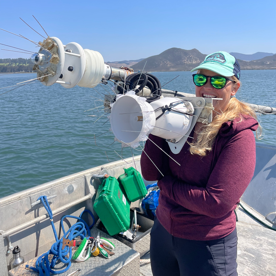
Diving technician Kaitlin Johnson holds the top-side pole at BS1 for repairs to the Gill weather station. (Credit: Ian Robbins / Cal Poly, SLO)
“I’ve always had a love for technology and troubleshooting and taking things apart and putting things back together. But I’ve also had a love for the natural environment… I forget how lucky I am to get to be able to tinker with stuff and take things apart, but also be able to put that interest in technical equipment to use towards monitoring the natural environment. And then, hopefully, have a bigger use or bigger impact with that monitoring, or the tools that I bring to the job.” explains Robbins.
He continues, “That data is used by a lot of other stakeholders and research groups at Cal Poly, SLO, that are able to utilize that data or apply their technical ability to whatever they’re interested in monitoring. Whether it is the aquaculture facilities or other research groups looking at Morro Bay and the environmental parameters that they’re trying to improve, or look at over time—it’s cool to be able to enjoy the technical aspect, but also look at the physical, chemical, or biological application and how that is applied by other groups.”
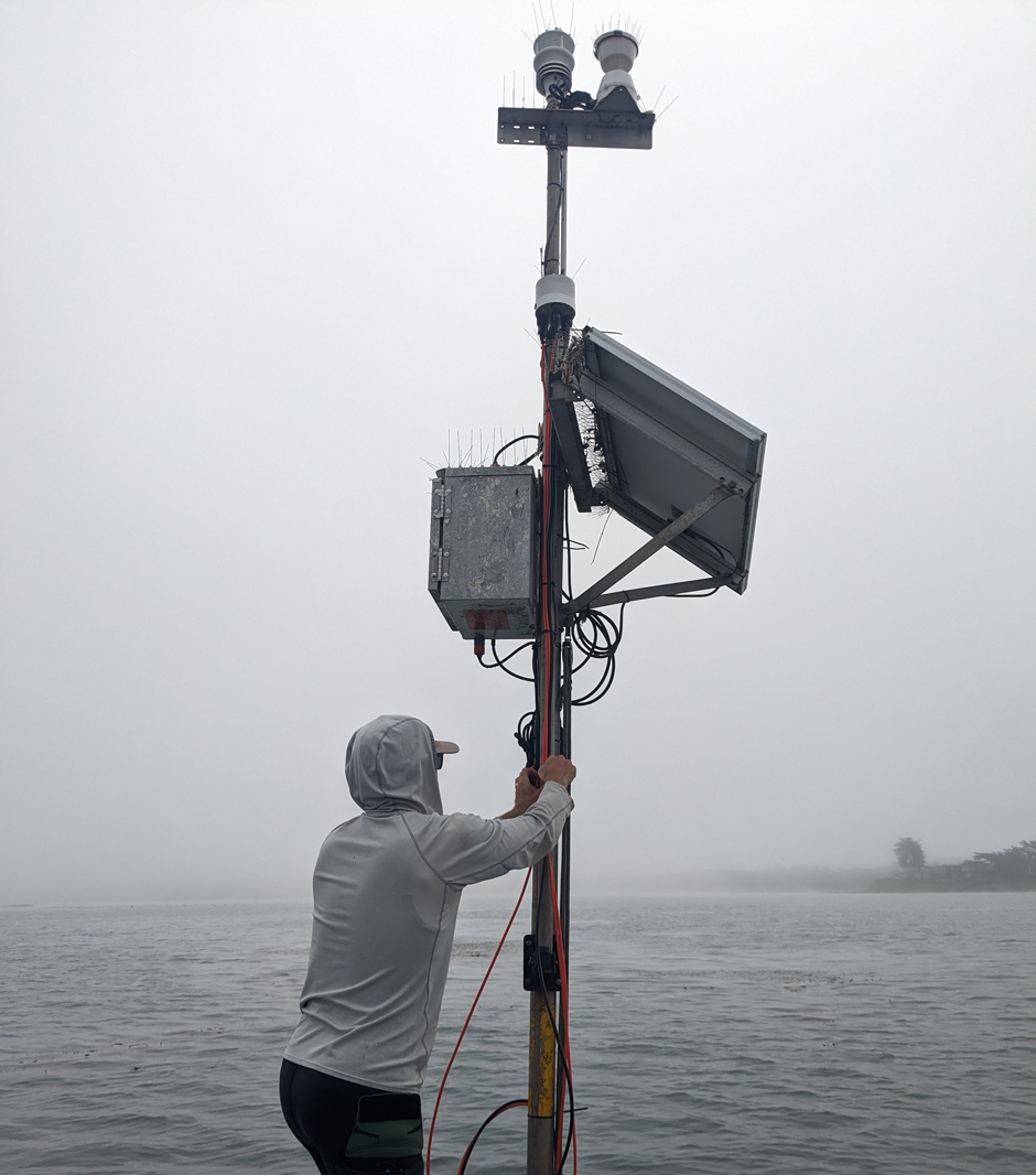
Senior Research Scientist Ian Robbins secures the station wiring after initial instrument and data logger deployment at BS1. (Credit: Ryan Walter / Cal Poly, SLO)


0 comments