Eurasian Watermilfoil Mapped With Hexacopter

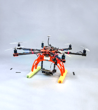
A modified hexacopter helps Michigan Tech scientists complete eurasian watermilfoil surveys. (Credit: Michigan Technological University)
In the Straits of Mackinac, where Lake Huron and Lake Michigan meet, eurasian watermilfoil has spread. There’s a similar situation in the Les Cheneaux Islands, where the invasive species has advanced enough to choke local waterways and hurt tourism.
To help with those problems, researchers at Michigan Technological University are using an unmanned aerial vehicle to do airborne surveys. Equipped with an advanced camera, the hexacopter is used to map areas affected by eurasian watermilfoil for high-resolution, scalable imagery.
Investigators are comparing the images gathered to satellite data in hopes of one day being able to see the invasive species from space. But getting there requires drone imagery that can refine knowledge of what satellites pick up.
Specifically, investigators are using spectrometer data to discern different signatures of plants from reflected light that returns from Earth to the atmosphere. They say that eurasian watermilfoil has a distinct, and very green, fingerprint in reflectance data.
Top image: A modified hexacopter helps Michigan Tech scientists complete eurasian watermilfoil surveys. (Credit: Michigan Technological University)


0 comments