
Great Lakes Research Center: Designing Targeted Monitoring Solutions
According to the National Oceanic and Atmospheric Administration (NOAA), the Great Lakes have more miles of coastline than the contiguous Atlantic and Pacific coasts combined and contain 20 percent of the world’s freshwater, making it a critical region to protect and conserve.
Continuous monitoring and data-informed resource management are key components of managing waters in the region.
Hayden Henderson, a research engineer with the Great Lakes Research Center (GLRC), designs and deploys monitoring platforms throughout the Great Lakes. With a background in environmental engineering, Henderson enjoyed the challenge of creating systems and making them work to obtain difficult, remote measurements.
“[I] always enjoyed building things and making them work, so deploying advanced sensors for measuring physical and biogeochemical variables in tough environments opened my eyes/set me down the path of wanting to make a career out of this. I just kept finding the next cool challenge in marine engineering and trying to tackle it,” states Henderson.
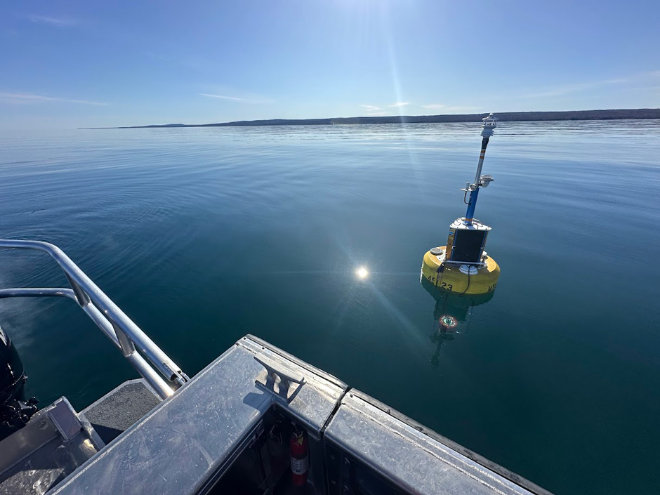
The Keweenaw North Entry buoy (NDBC 45023), which has been deployed at that location for over a decade. The northern shoreline of the Keweenaw Peninsula is in the background. (Credit: Hayden Henderson)
Rapid and Continuous Changes in the Great Lakes
There’s no place like the Great Lakes in terms of opportunities to develop unique and challenging monitoring solutions. Long-term exposure to anthropogenic stressors and climate change have led to rapid lake changes that are reshaping the ancient ecosystem, as well as local cities and towns that rely on the lakes for recreation and a source of income.
“We’re in an era where the Lakes are changing faster than we’re currently measuring and monitoring them. One of my hopeful continued contributions is continuing to push increasing the spatiotemporal scale at which we are monitoring the Great Lakes,” states Henderson.
He continues, “You can’t measure yesterday but you can start today–and we can’t know how much something increased over the last decade if we didn’t start measuring it 10 years ago!”
While modeling can help estimate conditions in the past, concrete data tells a more complete story and is needed to feed into these historical models and estimate future projections. Monitoring efforts that cover more time and space in the lakes build into a large view of the lake systems as a whole.
Due to the size and reach of the Great Lakes, inter-agency collaboration is necessary in order to monitor multiple points in each lake. The GLRC supports annual deployments for groups like NOAA, the Integrated Ocean Observing System (IOOS), the Great Lakes Observing System (GLOS), and other programs.
“We are a uniquely sized outfit as far as oceanography and limnology go. Our strong suits at the GLRC are agility and inventiveness,” states Henderson, who has spent his 3 years with the group conducting and overseeing several research projects and managing the center’s vessel fleet.
He adds, “I oversee our wonderful technicians and undergraduate interns, also helping maintain the Marine Research Assets Facility within our building. This shared use facility is made available to internal and external researchers on campus, with a wide range of support in the marine science space offered.”
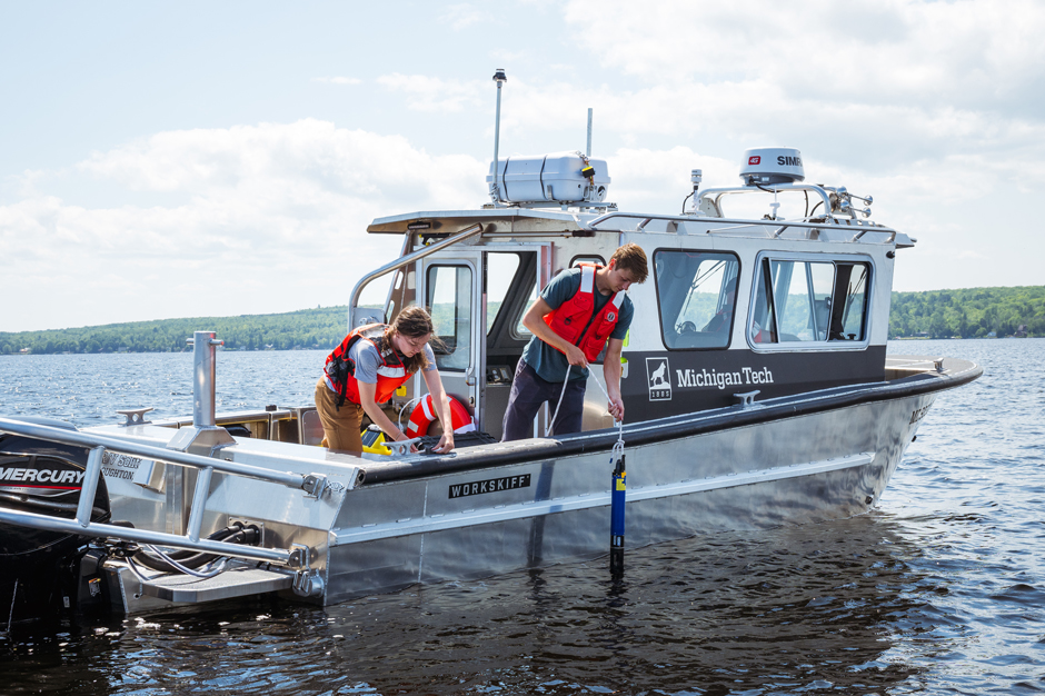
Two GLRC staff members sampling water quality using a YSI EXO2 in the Portage Waterway, which connects to Lake Superior on both ends. (Credit: Kaden Staley / Michigan Technological University)
Designing Monitoring Solutions for Each Ecosystem
In addition to providing supplemental research space at the center, the GLRC helps design systems specific to each lake and application.
Henderson explains, “There is such a gradient to the Great Lakes. For some optical instruments, this means buying them with completely different pathlengths for one lake versus another, or even from one basin to another in the same lake.”
He compares Lake Superior and Lake Erie, which have very different levels of primary production and require different monitoring solutions.
Superior being so oligotrophic means detecting rudimentary parameters like chlorophyll can be difficult, and therefore, sensors need to offer a low, precise range. In contrast, Erie is eutrophic and requires frequent sonde and sensor maintenance due to biofouling.
Each of the systems are built out from a NexSens data buoy and instrumented depending on site locations, monitoring needs, and project goals. Commons sensor selection includes SVS603 HR wave sensors, Gill Maximet 501, YSI EXO2 and EXO3, TS210 temperature strings, Pro Oceanus mini pCO2, Pro Oceanus Pro ATM pCO2, TriOS NICO Plus, and Nortek ADCPs.
Instrumentation and maintenance schedules vary depending on lake conditions and manufacturer guidelines. Integrated real-time data loggers make the data available remotely and collect a highly granular dataset.
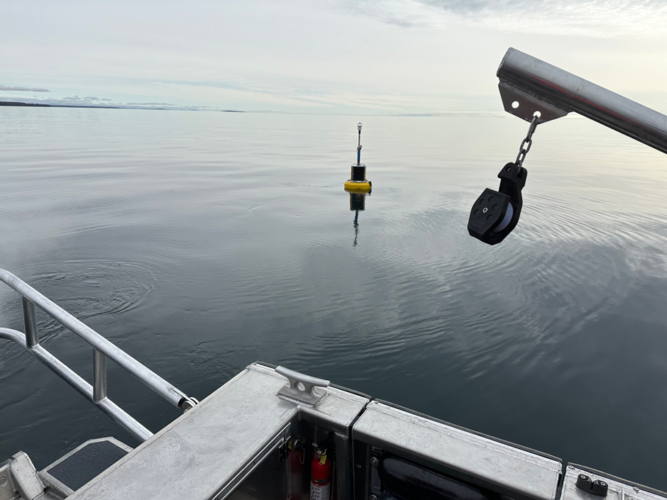
The Keweenaw South Entry buoy (NDBC 45025) after deployment, with Rabbit Island in the background. (Credit: Hayden Henderson)
Conclusion
This sensor-logger configuration on the NexSens buoys is meticulously designed to meet environmental demands and data needs. While challenging, this is what makes the work rewarding, according to Henderson.
He explains, “On a science cruise in the Pacific, I heard John Fram from Oregon State say, ‘If you achieve at 99 percent in the classroom, that’s an A–no question about it. If you build something to 99% and put it in the water, it will break.’”
He continues, “So, really, the pursuit of success is the most rewarding part. Successfully building and deploying something that sends data back from far-off places, 24 hours a day, that’s the reward. Obtaining hard-to-get data at temporal or spatial scales that help resolve unknowns–that’s the reward.”


0 comments