Lake Whillans: Like Wetland, Fed By Ice Melt

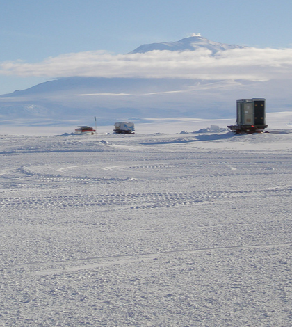
A section of the Ross Ice Shelf, which Lake Whillans sits beneath. (Credit: Flickr User alan_light via Creative Commons 2.0)
In the last few decades, scientists have used tools including airborne radar and satellite laser measurements to see that there’s a continental system of lakes and rivers underneath Antarctica’s ice sheets. This includes Lake Whillans, which is smaller than the largest subglacial lake, Lake Vostok, which is about as large as Lake Ontario.
But despite those discoveries, most of the subglacial lakes remain undescribed in great detail. Luckily, scientists have begun to chip away at this gap in understanding.
Three new publications by researchers at different institutions provide a first look into the features of Lake Whillans, which sits 2,600 feet beneath the West Antarctic Ice Sheet. Much of their findings were made possible through the Whillans Ice Stream Subglacial Access Research Drilling (WISSARD) project.
In that project, scientists and drillers used a custom, clean, hot-water drill to obtain direct samples from the waters and sediments of Lake Whillans. These revealed the presence of microbial life in the lake and offered the opportunity for further study.
Some of the initial analyses of the samples taken from the lake are highlighted in the recent papers, published in three different journals. Researchers used an array of biogeochemical, geophysical and geological methods to gain insights into the dynamics of the subglacial system.
In a paper published in Geophysical Research Letters, scientists at Scripps Institution of Oceanography at the University of California, San Diego, report that GPS data gathered over a period of five years indicate there’s periodic drainage of the lake that can increase velocity at the base of the ice sheet. This can speed up movement of the ice by as much as 4 percent in episodic bursts, each of which can last for several months. The findings may be useful in refining the prediction of future, long-term ice sheet changes.

View of the bottom of Antarctic subglacial Lake Whillans, captured by a high-resolution imaging system aboard NASA’s Micro-Submersible Lake Exploration Device. (Credit: NASA Jet Propulsion Laboratory)
In a second paper, published in Geology, researchers from Montana State University used data taken from a 15-inch core of lake sediment to characterize water chemistry in the lake and its sediments. Their findings indicate that lake water comes primarily from melting at the base of the ice sheet covering the lake, with a minor contribution from seawater, which was trapped in sediments beneath the ice sheet during the last interglacial period
This ancient, isolated reservoir of ocean water continues to affect the biogeochemistry of the lake system. The findings contrast with previous studies from neighboring ice streams, where water extracted from subglacial sediments hasn’t appeared to have a discernable marine signature.
In the third paper, published in the journal Earth and Planetary Science Letters, scientists at Northern Illinois University examined another sediment core taken from the lake to discover more about the relationship between the ice sheet, subglacial hydrology and underlying sediments.
Their findings show that even though floods pass through the lake at times, the flow is not powerful enough to erode extensive drainage channels like the rivers that drain much of the Earth’s surface. Instead, the environment beneath this portion of the ice sheet is somewhat similar to a wetland within a coastal plain where bodies of water tend to be broad and shallow and where water flows gradually.
Collectively, the researchers have described a wetland-like area beneath the ice. Subglacial Lake Whillans is primarily fed by ice melt, but also contains small amounts of seawater from ancient marine sediments on the lake bed. The lake waters periodically drain through channels to the ocean, but with insufficient energy to carry much sediment.
The new insights will not only allow scientists to better understand the mechanics of the lake itself, but will also allow them to use that information to improve models of how Antarctic subglacial lake systems interact with the ice above and sediment below. These models will help assess the contributions that subglacial lakes may make to the flow of water from the continent to the ocean, and therefore to sea-level rise.
Funding for the WISSARD project was provided by the National Science Foundation.
Top image: A section of the Ross Ice Shelf, which Lake Whillans sits beneath. (Credit: Flickr User alan_light via Creative Commons 2.0)


0 comments