Turbidity sensors boost monitoring of Mount St. Helens eruption’s long sediment legacy

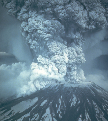
Scientists are still dealing with aquatic effects of sediment from the 1980 eruption of Mount St. Helens (Credit: Austin Post)
Mount St. Helens has mostly faded from international headlines since the volcano erupted and blew a cloud of ash and debris 15 miles into the sky in 1980. But the aftermath of the eruption is a matter of daily life for scientists dealing with the debris in the rivers that drain the mountain’s north flank.
The eruption followed an earthquake that triggered a debris avalanche, which cut the mountain’s peak by 1,300 feet and sent nearly 3 billion cubic yards of sand and gravel careening 20 miles down the North Fork Toutle Valley. Much of that continued downstream from the Toutle River into the Cowlitz River, where it built up on the riverbed, raising the water level and the risk of flooding for communities like Castle Rock and Longview.
Today, the U.S. Geological Survey and Army Corps of Engineers collaborate on a multi-million-dollar effort to track and trap sediment in the Toutle River. The long record helps the corps plan modifications to its sediment-blocking dam on the Toutle, as well as project how long the high sediment concentrations will persist — which is apparently well into the foreseeable future.
“Every indication is it will be for years, and probably decades,” said Kurt Spicer, a hydrologic technician with the USGS.

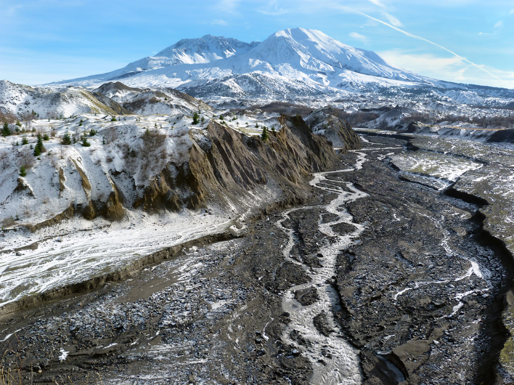
The North Fork Toutle River flowing away from the peak of Mount St. Helens (Credit: Kurt Spicer/USGS)
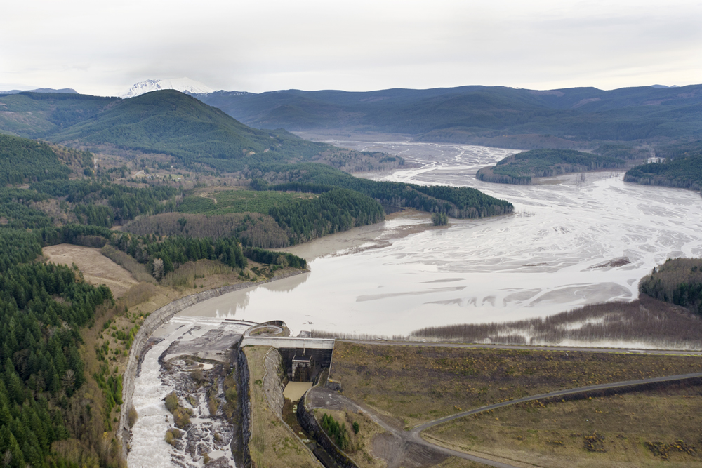
Keeping track of sediment in the Toutle is especially important for maintaining the corps’ Sediment Retention Structure, a 1,888-foot earthen dam built for $65 million in 1989. The corps designed the SRS to hold back 235 million cubic yards of sediment until 2035, but it had nearly reached capacity by 2012. A $4.5 million upgrade raised the spillway by 7 feet.
Spicer has made a career out of monitoring sediment on the Toutle, which has included developing the plan to measure concentrations in the river. That’s labor-intensive work that requires multiple and frequent samples. But recent work by Spicer and Mark Uhrich, a USGS hydrologist, shows that using data from optical turbidity sensors could cut down on trips to the river while getting managers the data they need much more quickly.
Uhrich helped pioneer the use of turbidity sensor data as a surrogate for suspended sediment concentrations while working on rivers in Oregon, but it wasn’t clear that the technique would work on the Toutle. The sand-rich sediment is abrasive, which could be tough on optical instruments, and concentrations can be highly variable. But, as Uhrich, Spicer and other researchers have spelled out in a recent USGS report, the results are promising.
“We were really surprised,” Uhrich said. “Turbidity monitoring has worked really well here.”

The Sediment Retention Structure on the North Fork Toutle River (Credit: Adam Mosbrucker/USGS)
Researchers traditionally calculate sediment loads by collecting samples across the channel and relating the concentrations to streamflow measured at gauging stations, a process that can take months. By building a relationship between sample-based sediment concentrations and immediate readings from turbidity sensors, the team can speed up that processes considerably.
The turbidity sensors also give them real-time estimations of sediment concentrations for the first time.
“It gives us a greater feel for what’s coming down the river,” Spicer said.
That’s important because spikes in sediment don’t always depend on storms washing sand into the river. Sometimes banks collapse, for example. The corps recently installed grade-building structures in the upper river, and the work stirred up sediment. The turbidity sensors captured that, alerting the scientists to a spike in sediment that they otherwise would have missed.
“We sent somebody out there, and sure enough the river was dirty as all get out,” Uhrich said.

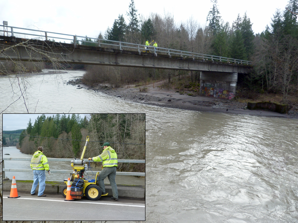
Suspended sediment sampling on the Toutle River (Credit: Kurt Spicer/USGS)
Mount St. Helens still makes news when the volcano acts up, including the 2004-2008 eruption that built a new lava dome within the crater of the 1980 eruption. More recent headlines tease a pending future eruption. Though the risk of another catastrophic eruption is easier to grasp, the day-to-day sediment monitoring continues to play a role in protecting downstream communities.
“Flood risk is not something you can see very easily. What the bottom of the river is doing in the Cowlitz is not obvious,” Spicer said. “It’s not the kind of stuff that jumps out at you when you go up to visit the visitor center.”
Top image: Scientists are still dealing with aquatic effects of sediment from the 1980 eruption of Mount St. Helens (Credit: Austin Post)


0 comments