NASA Makes Push For Firesat, A Global Wildfire Detection System

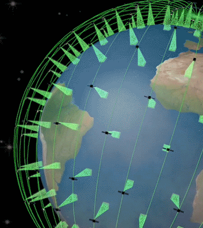
Proposed constellation of satellites with thermal infrared imaging sensors that would locate wildfires. (Credit: Quadra Pi R2E)
A team at NASA’s Jet Propulsion Laboratory is working to bring about a network of space-based sensors that could conceivably locate and track wildfires all across the globe, according to a release from the agency. They are calling the concept Firesat.
If materialized, such a network would consist of more than 200 thermal infrared imaging sensors deployed on satellites circling the planet. The Firesat network they envision would be the most complete fire-monitoring network ever, and able to detect fires at least 35 to 50 feet in width, within about 15 minutes after they begin blazing.
The idea for the extensive network has only recently become possible, thanks to advances in sensor technology and reduced costs. But there are still plenty of obstacles to forming Firesat, including funding for the effort. To help, researchers have launched a campaign on the crowdfunding website Kickstarter.
Top image: Proposed constellation of satellites with thermal infrared imaging sensors that would locate wildfires. (Credit: Quadra Pi R2E)


0 comments