National Hurricane Center to highlight storm surge risk in color-coded maps

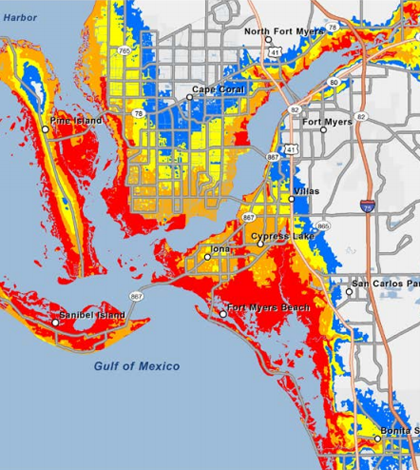
An example of the new storm surge map style (Credit: NOAA National Hurricane Center)
Scientists at the National Hurricane Center will release new maps for forecasting storm surge beginning this Atlantic hurricane season, according to Reuters. The maps will be color-coded to show how far floods can reach.
Previous forecasting methods had trouble accentuating the risk of staying in areas close to shore, scientists say. With the color codes, they hope those living in high-risk areas will make better preparations or evacuate sooner.
Much attention is paid to a hurricane’s wind speeds as it approaches land. But scientists say this is misplaced, noting the greatest number of deaths associated with hurricanes come from storm surge flooding.
Image: An example of the new storm surge map style (Credit: NOAA National Hurricane Center)


0 comments