North Pacific Ocean Waves May Contribute To Ross Ice Shelf Shifts

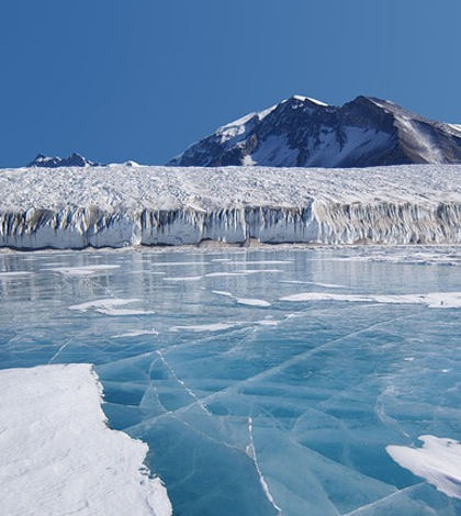
Lake Fryxell, Antarctica. (Credit: Public Domain)
A network of seismometers deployed across Antarctica’s Ross Ice Shelf has revealed that wave energy generated thousands of miles away may be contributing to the shelf’s disintegration. Most of the waves, scientists say, appear to originate in the North Pacific Ocean.
The Ross Ice Shelf is the largest ice shelf in Antarctica, measuring 188,000 square miles, an area roughly the size of Texas, and restrains a sector of the grounded West Antarctic Ice Sheet that could contribute as much as three meters of sea-level rise if it melted. Essentially, disintegration of the Ross Ice Shelf wouldn’t directly cause sea levels to rise, but could remove the buttress that holds back the grounded ice sheet behind it.
Thirty-four seismometers were deployed across the ice shelf between 2014 and 2015. Those revealed the characteristics of seismic signals generated by surface wave impacts to the ice shelf. Variations in the signals tipped researchers off to areas of stronger or weaker ice, which affected vibrations propagating through the sheet.
“The seismic survey studying the vibrations of the Ross Ice Shelf (RIS) in response to wave impacts will provide on-ice information on the structure and strength of the RIS, giving baseline ‘state-of-health’ ice shelf measurements that can be used to identify the magnitude of changes in its integrity over time,” said Peter Bromirski, an oceanographer at Scripps Institution of Oceanography and principal investigator on the project, in a statement.

A map of the Ross Ice Shelf seismic array. (Credit: Scripps Institution of Oceanography)
The seismic data showed that impacts of very long wavelength ocean waves and ocean-swell induced vibrations in the ice can be felt up to 62 miles away from the front of the Ross Ice Shelf. Much of the ocean wave energy originates in the North Pacific Ocean, which causes higher amplitude vibrations than waves generated locally in the Southern Ocean.
Bromirski says that he and others still don’t fully understand the dominance of the long-distance wave energy. And the preliminary data so far collected don’t explain if the signals are generated at the shelf front or closer to the stations near the ice shelf’s base, where wave energy could be penetrating a water cavity under the shelf.
To get at those questions, the project will be expanded in the next field season to include 13 geodetic GPS stations co-located with selected seismic stations, including five stations near the shelf front. These GPS stations will give continuous measurements during the austral summer, with one station operating year round.
Results of that effort will be combined with an upcoming analysis of atmospheric conditions over Antarctica, which will provide a comprehensive view of physical processes that could lead to substantial sea-level rise in all global oceans.
A team of Scripps researchers plans to recover the first full year of data from the existing array of seismometers this winter. Institutions partnering with them in the work include Woods Hole Oceanographic Institution, Washington University in Saint Louis, Colorado State University and Penn State University.
Full findings of the preliminary investigation, including methods and results, are published in the journal Geophysical Research Letters.
Top image: Lake Fryxell, Antarctica. (Credit: Public Domain)


0 comments