Wright State Research Institute developing, testing unmanned aerial systems

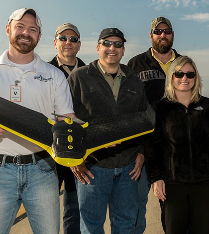
Scientists at the Wright State Research Institute display one of their UAS aircraft. (Credit: Wright State University)
Scientists at the Wright State University Research Institute are working to build new and advanced unmanned aerial systems (UAS). They have developed several over the years and recently tested a new one at Ohio’s Wilmington Air Park, where park managers are looking to create a virtual model of the test range.
“Once this virtual model is complete, the operator can virtually fly his UAS on the test range before proceeding to a more costly live test flight,” said Bruce Preiss, lead research engineer at Wright State Research Institute.
In addition to generating the model of the test range, the test flight helped scientists to demonstrate flight capabilities while collecting imagery used in making a three-dimensional map. Data collected along the way were also used to make simulations of the surrounding geographic area more accurate.
The successful test flight also helped to advance other research into UAS applications in general, a budding industry that could be worth billions of dollars once the systems are approved for broader use by the Federal Aviation Administration.
The research and monitoring applications are numerous, and Preiss sees the crafts one day aiding in environmental monitoring applications like evaluating wildlife areas, tracking forest fires or watching algae formation in lakes with hyperspectral sensors. But experts at the Wright State Research Institute have other goals in mind for the technology.

Scientists at the Wright State Research Institute display one of their UAS aircraft. (Credit: Wright State University)
“So much money in industry, the private sector and government is wasted during the design process,” said Preiss. “When a problem occurs later on down the product development line, and a re-design of the overall system is necessary, then the costs immediately sky-rocket.”
Design work so far has focused on making unmanned aerial systems that are robust and adaptable platforms, capable of supporting multiple sensors at a time. These still have to be lightweight enough to maneuver efficiently.
“A good general rule of thumb is to identify a problem, or application for the UAV (unmanned aerial vehicle) and then specifically determine the mission,” said Preiss. “From this specification, the type of sensor needed can be determined to acquire the necessary information.” Knowledge of the sensor’s weight helps determine the weight and actual dimensions of the aerial system from there.
Aircrafts that the Wright State Research Institute has developed using that approach include quadcopters, fixed-wing aircraft and gliders. These can be launched from the ground or on systems mounted to vehicles.


0 comments