
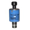
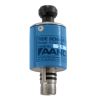
Aanderaa 5218 Wave & Tide Sensors
Features
- Smart sensor technology for plug-and-play interface
- 2Hz and 4Hz sampling frequency
- Maximum operating depth of up to 90m
- Expedited repair and warranty service
- Lifetime technical support
- More
Overview
The Aanderaa 5218 Wave & Tide Sensor is a compact, fully integrated sensor for measuring wave and tidal conditions. The sensor is designed to be mounted on the Aanderaa SeaGuardII top-end plate or in other measurement systems using the RS-232 interface.
Applications
The sensor application areas are in fixed installations, either deployed in a seabed installation in shallow waters or mounted onto a fixed structure in the upper water column. Typical applications for the sensor are measuring waves and tides in ports and harbors, marine operations, weather forecasts, and climate studies.
Mechanics
The tide measurement is an average of the hydrostatic pressure measured over a time period of 10 seconds to 8 minutes (integration time configurable by the user). The update interval is between 1 second and 255 minutes. The wave measurements are based on the pressure time series measured over a time period of 64 seconds to 17 minutes (configurable by the user). The update interval is between 1 second and 255 minutes.
Parameters
The wave and tide sensor output parameters are Pressure, Tide Level, Tide Pressure, Temperature, Significant wave height, Maximum wave height, Mean period, Peak period, Energy wave period, Mean zerocrossing period, Wave steepness, and irregularity of sea-state. Since all calibration and temperature compensation data are stored inside the sensor, the parameters are, by default, presented directly in engineering units without any external calculation. The sensor also provides raw data on the pressure and temperature measurements.
Select Options


In The News

Supplying Seattle’s Drinking Water: Using Data Buoys to Monitor the Cedar River Municipal Watershed
Providing clean, safe, and reliable drinking water for the 1.6 million people in the greater Seattle area is a top priority for Seattle Public Utilities (SPU). With limited water supplies, SPU dedicates considerable resources to maintain its watersheds and mountain reservoirs. About 70 percent of Seattle Water comes from the Cedar River Municipal Watershed , and the other 30 percent comes from the South Fork Tolt River Watershed . [caption id="attachment_39574" align="alignnone" width="940"] Data buoy in Chester Morse Lake . (Credit: Kevin Johnson / Seattle Public Utilities) [/caption] Jamie Thompson, a fisheries biologist at SPU, monitors aquatic ecosystems centered on fish listed under the U.S. Endangered Species Act (ESA).
Read More
Data-Driven Advocacy on the Lower Deschutes River
Like many freshwater environments, the Deschutes River in Oregon is under pressure from development, pollution, and climate change. Many rivers, streams and lakes in the Deschutes Basin do not meet Oregon water quality standards –where state water quality monitoring assesses levels of bacteria, pH, dissolved oxygen, temperature, and fine sediment. Hannah Camel is the Water Quality Coordinator for the Deschutes River Alliance (DRA), a non-profit organization that focuses on the health of the lower 100 miles of the Deschutes River–the area most affected by human intervention. As a data-driven organization, the DRA has benefited from the installation of two NexSens X2 data loggers.
Read More
Expanding the Port Everglades: Real-Time Monitoring of Water Quality Conditions from Planned Dredging Operation
The Port Everglades in Broward County, Florida, serves large trade vessels and cruiseliners and incoming and outgoing recreational boaters. However, as cargo ships become larger, the port must expand. A dredging project led by the US Army Corps of Engineers will substantially deepen and widen the port's navigation channel to accommodate larger Panamax cargo ships and modern cruise liners. As a result of this project, a large amount of sediment will be displaced into the water column. This suspended sediment may settle outside of the project area, burying benthic organisms like corals, and possibly carrying harmful particulates to other regions. [caption id="attachment_39497" align="aligncenter" width="2560"] A CB-950 and CB-25 deployed on site at Port Everglades.
Read More