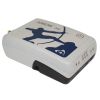
Eos Arrow 100 GNSS Receivers
Features
- Full GNSS: GPS/GLONASS/Galileo/BeiDou/QZSS
- 100% Android, iOS, Windows compatible
- 30-60cm real-time accuracy using free SBAS
- Free ground shipping
- Expedited repair and warranty service
- Lifetime technical support
- More
High-Accuracy GNSS Receiver for any Smartphone, Tablet, or Laptop Computer
The Arrow 100 incorporates rock-solid, wireless Bluetooth technology to ensure high-accuracy locations and metadata can be provided to any device, making it a future-proof submeter GNSS receiver that can evolve with mobile hardware and software choices.
Works with any Mobile GIS App
The Arrow 100 GNSS receiver does not require any additional hardware or software in order to obtain submeter positioning. The Arrow 100 streams this submeter location data into any chosen mapping or data-collection app on a mobile device.
Real-time Submeter (or Better) Accuracy, Worldwide
The Arrow 100 takes advantage of all the global GNSS constellations for positioning: GPS, GLONASS, Galileo, BeiDou. Moreover, with free SBAS corrections in most regions of the world, this receiver provides 30 to 60cm real-time accuracy. For areas without free SBAS, the Arrow 100+ is available and supports the Atlas H50 satellite subscription service to achieve 30-50cm accuracy worldwide.
Multiplexing with the Arrow 100+
The Arrow 100+ has the functionality of the Eos Bridge Bluetooth connector built-in. Connect the Arrow 100+ to any third-party sensor (e.g., laser rangefinder). The Arrow 100+ streams the content of that sensor to iOS or other mobile devices via the receiver's own location datastream.
Works Where Other Receivers Can't
The Arrow 100 was explicitly designed with GIS users in mind. When GPS satellites are just not enough, the Arrow 100 connects to GLONASS, Galileo, and BeiDou signals, creating access to at least 100 satellites! This GNSS receiver squeezes more accuracy from SBAS corrections than any other receiver in the world. The Arrow 100 delivers superior accuracy and performance under trees, buildings, and rugged terrain. Accurate positioning occurs in real-time, with no post-processing required. The Arrow 100 also features the ability to be used with single-frequency RTK. Achieve 1cm accuracy when the baseline is less than 10km (6 miles).
- (1) Arrow 100 receiver with Arrow Smart Battery Pack
- (1) Single-Frequency GNSS / LBand Precision Antenna
- (2) Antenna Cables
- (1) Soft hat for Antenna
- (1) Nylon Carrying Case (belt-clip & shoulder strap)
- (1) 12V International Power Supply for Arrow Smart Battery
- (1) USB Data Cable
In The News
Tsunami's Effects Lasting Years for Marine Creatures
Adrift on the open ocean, even aquatic species can feel stranded, without their usual habitats and food sources. This has been the situation for various species post-201 1 Japanese tsunami for years now. Researchers are digging into the lasting effects this displacement could have on them—and on the places they end up. Dr. Linsey Haram , a postdoctoral fellow at the Smithsonian Environmental Research Center (SERC) , spoke to EM about her research following the winding path of some of these species. "I wasn't directly involved with the tsunami debris work because I hadn't started working at the Smithsonian," explains Dr. Haram.
Read MoreITAG: a Neutrally Buoyant Sensor Device for Squishier Species
To conduct behavioral research on aquatic species especially invertebrates with softer bodies, tagging and tracking has been a persistent challenge. This is particularly true for species which are often elusive in the first instance. Woods Hole Oceanographic Institution research assistant Seth Cones spoke to EM about recent testing of a new sensor and tagging technology that might make this challenge a bit easier. “The version of the tag that I’m currently working on was a work in progress in summer 2018,” explains Mr. Cones.
Read MoreEos Arrow receivers give GIS pros real-time data, solid connectability
For pros working in mapping, surveying and other GIS fields, quick, precise data are a must. And the key to getting those data is getting the right receiver. As a result, many turn to high-accuracy, multi-constellation receivers like the Arrow series built by Eos Positioning Systems. The series includes the Eos Arrow Lite GPS Receiver, Eos Arrow 100 GNSS Receiver and Eos Arrow 200 L1/L2 GNSS Receiver. The receivers are popular for many reasons: They have the flexibility to use multiple satellite constellations, offer real-time data transmission capability and can connect to any device via Bluetooth. The Arrow receivers use the United States’ GPS constellation of satellites, but they can just as easily link up with Russia’s GLONASS, China’s Beidou and Europe’s Galileo.
Read More


