
Eos Arrow 200 GNSS Receiver
The Eos Arrow 200 is a GNSS receiver capable of providing 1cm real-time accuracy on any Android, iOS and Windows mobile device.
Features
- Supports existing and future GNSS (GPS, GLONASS, Galileo, BeiDou)
- 100% Android, iOS, Windows compatible
- 1cm RTK real-time accuracy
- Free ground shipping
- Expedited repair and warranty service
- Lifetime technical support
- More

The World’s First RTK Receiver for Every Mobile Device
Designed for use with a broad range of mobile devices, from smartphones to tablets and notebook computers, the Eos Arrow 200 incorporates rock-solid, wireless Bluetooth technology that works smoothly with Android, iOS, and Windows devices, making it obsolete-proof and portable across platforms.
Consumer Choice of Mobile GIS Software
The Arrow 200 feeds 1cm RTK accuracy to every app on Android or iOS devices, including Google or Apple maps. The Arrow 200 works seamlessly with Esri Collector/ArcPad/ArcMobile, Fulcrum, AmigoCloud, TerraFlex, MapItFast, GeoJot, iCMTGIS and many more mapping apps.
All Satellites, All Signals
The Eos Arrow 200 incorporates premium features that place it among the highest-performing receivers in the world. It takes advantage of all existing satellite constellations (GPS, GLONASS, BeiDou, SBAS) as well as emerging and planned constellations (Galileo and QZSS) to deliver top-notch, 1cm RTK performance anywhere in the world when connected to an RTK Network or 10-15cm accuracy using OmniSTAR HP or G2.
The Ultimate in Worldwide High-Precision GNSS Technology
The Arrow 200 provides ultimate flexibility. Use one of OmniSTAR’s services to get 10cm real-time accuracy anywhere in the world. Collect data anywhere in the world using Eos’ free data collection program and post-process the data using free online processing services like PUS or AUSPOS to achieve centimeter accuracy anywhere.
- (1) Arrow 200 receiver with Arrow Smart Battery Pack
- (1) Dual-Frequency GNSS / LBand Precision Antenna
- (1) Large Antenna Mounting Plate
- (1) Two-section Short Antenna Cable for survey pole
- (1) Arrow Pole Mount Bracket
- (1) Range Pole Clamp
- (1) USB Data Cable
- (1) 12V International Power Supply for Arrow Smart Battery pack
- (1) Hard Shell Case
Select Options


In The News
Eos Arrow receivers give GIS pros real-time data, solid connectability
For pros working in mapping, surveying and other GIS fields, quick, precise data are a must. And the key to getting those data is getting the right receiver. As a result, many turn to high-accuracy, multi-constellation receivers like the Arrow series built by Eos Positioning Systems. The series includes the Eos Arrow Lite GPS Receiver, Eos Arrow 100 GNSS Receiver and Eos Arrow 200 L1/L2 GNSS Receiver. The receivers are popular for many reasons: They have the flexibility to use multiple satellite constellations, offer real-time data transmission capability and can connect to any device via Bluetooth. The Arrow receivers use the United States’ GPS constellation of satellites, but they can just as easily link up with Russia’s GLONASS, China’s Beidou and Europe’s Galileo.
Read More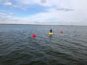
From Pans to Buoys: Advancing Reservoir Evaporation Rate Monitoring in Texas
In warmer climates like Texas, high reservoir evaporation rates can lead to declines in water level and water availability during droughts, making monitoring essential in order to ensure water security during times of scarcity. According to the Texas Water Development Board (TWDB), evaporation rates in Texas were previously based on data collected from a sparse network of Class A evaporation stations, dating back to the 1960s. These pans were stationed near reservoirs and still remain a widely accepted standardized approach to measuring evaporation rates on land. Monthly pan-to-lake coefficients were developed in the 1980s to connect the data collected from the pans to known lake conditions, extrapolating evaporation rates of the lakes using the pan data.
Read More
A Drop in the Ocean: Restoring London’s Tidal Thames
The United Kingdom has grappled with wastewater management problems for decades. Although sewage treatment in the 20th century allowed many rivers, including the tidal Thames, to have healthy fish populations, combined sewer overflows into rivers–most commonly during heavy rainfall–affected water quality and occasionally even killed fish. Problems reached a head in 2012 when multiple infractions of European urban wastewater treatment laws threatened costly fines, on top of the environmental cost of repeated sewage spills into British rivers. Fast forward to 2025, and after a decade of construction work, London’s Thames Tideway Tunnel , affectionately dubbed the “super sewer”, is now fully activated and ready for testing.
Read More