
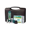
Extech ExStik Chlorine Meter
Features
- Low detection limit down to 0.01ppm
- Unaffected by sample color or turbidity
- Automatic electronic calibration
- Free ground shipping
- Expedited repair and warranty service
- Lifetime technical support
- More
Overview
The Extech ExStick Chlorine Meter features a unique flat surface electrode that conducts direct total chlorine readings. The range is 0.01ppm to 10ppm, and the measurements are unaffected by the color or turbidity of the sample. The memory stores, tags, and recalls up to 15 readings and calibrations. The 2000 count LCD simultaneously displays ppm of total chlorine and temperature plus analog bargraph indicator.
- ppm range: 0.01 to 10.00ppm (10 to 50ppm using dilution method)
- Temperature range: 23° to 194°F (-5 to 90°C)
- Resolution: 0.01ppm ; 0.1°F/°C
- Accuracy: ±10% of reading ±0.01ppm; ±1.8°F/±1°C
- Power: four SR44W button batteries
- Dimensions: 1.4 x 6.8 x 1.6" (35.6 x 172.7 x 40.6mm)
- Weight: 3.85oz (110g)
- (1) ExStik chlorine meter
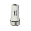
- (1) Flat surface chlorine electrode
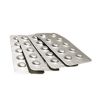
- (50) ExTab reagent tablets
- (1) Protective sensor cap
- (1) Sample cup with cap
- (4) 3V CR-2032 batteries
- (1) 48" (1.2m) neckstrap
Select Options


In The News

Wildfire Prevention in the Sierra Nevada Region with the Yuba Watershed Institute
Though recent wildfires have sparked new conversations about wildfire management and response, groups like the Yuba Watershed Institute have been monitoring the forests and water resources of the Sierra Nevada region for decades, managing approximately 5,000 acres of land with the Bureau of Land Management (BLM) and about 7,000 acres in private land partnerships. The goal of the Institute is to work with local communities and land agencies to improve watershed and forestry management through informed practices and public outreach. The goals of the Yuba Watershed Institute are three-fold: Improve the ability of fire suppression agencies like the California Department of Forestry and Fire Protection ( CAL FIRE ) and the US Forest Service.
Read More
Wave Sensors Integration with NexSens Buoys: A Cutting-Edge Solution for Wave Measurment
Real-time wave data supports accurate weather prediction, safe and efficient maritime operations, and provides valuable safety and operating condition information for recreation and commercial fishing. Understanding wave dynamics also helps with the design of protective coastal structures like seawalls, breakwaters, and jetties. It also supports better prediction of their impact on sediment transport and coastal geomorphology. Wave data is a key factor in qualifying and designing offshore wind farms and harnessing kinetic energy for electrical generation. It helps with the understanding of ocean-atmosphere interactions and contributes to studies of sea-level rise and climate change impacts.
Read More
Spring 2025 Environmental Monitor Available Now
In the Spring 2025 edition of the Environmental Monitor, we highlight partnerships across the world and the importance of collaboration between government agencies, universities, environmental groups, local communities, and other stakeholders. From great white shark research in Cape Cod to monitoring fisheries in Lake Erie, this latest edition underscores partnerships that connect stakeholders in a watershed through environmental data. With an emphasis on data sharing, a combination of real-time and discrete sampling keeps the public and partners informed of environmental conditions. Our writers also sought out science professionals dedicated to working with peers within and outside of the environmental sector.
Read More