Garmin GPS 24xd HVS Marine GNSS Receiver
Features
- Provides access to GPS, Galileo, GLONASS and BeiDou satellite systems
- Accurate to <1 meter CEP, <3 meters 95%
- IPX7 waterproof sensor with pole and flush mount options
- Free ground shipping
- Expedited repair and warranty service
- Lifetime technical support
- More
GPS 24xd HVS
The highly accurate GPS 24xd HVS position receiver/antenna provides up to 10 Hz update rates for position, velocity and time data. It offers high-sensitivity reception and enhanced position acquisition to the Garmin family of marine instruments, autopilots and multifunction displays.
Delivers Precise Location Data
This receiver is capable of tracking multiple global navigation satellite systems, including GPS, Galileo, GLONASS and BeiDou. Since more satellites are visible, it can provide more accurate fixes in challenging conditions. WAAS-capable, it can determine precise location to within <1 meter CEP, <3 meters 95%.
Observable Advantages
Compared to units with slower update rates, the GPS 24xd offers dramatic improvement when used at low speeds. Position and course information from slower units can jitter and swing considerably at speeds below 1 mph. The GPS 24xd provides a consistent and smooth heading which is especially important when trying to hit a specific waypoint or mark.
Built for Versatility
Part of the Garmin marine instrument family, the GPS 24xd HVS is built to withstand the elements. This waterproof (IPX7) sensor can be pole mounted or flush mounted. It also can be attached to the underside of many fiberglass decks for added ease of installation. In addition, it also can be configured to have 1 Hz or 5 Hz update rates to help support specific installation requirements.
- Dimensions (D x H): 3 19/32" x 1 15/16" (91.6 mm x 49.5 mm)
- Weight: 7.1 oz (201 g)
- Cable length: 30 ft (9.14 m)
- Temperature range: -22° to 176° F (-30° to 80° C)
- Case material: Fully gasketed, high-impact plastic alloy; waterproof to IPX7
- Compass-safe distance: .5" (12.7 mm)
- Power source input: 8-32V, unregulated
- Input current: 150 mA at 12 Vdc
- Position accuracy, typical marine use: < 50 cm, CEP 50%; < 1.0 meter, 88%
- GPS 24xd HVS
- Pole mount
- Surface mount
- Under deck mount
- Power/data cable
- Update rate select cable
- Documentation
In The News
Monitoring and Facilitating Habitat Restoration Efforts in the Great Lakes
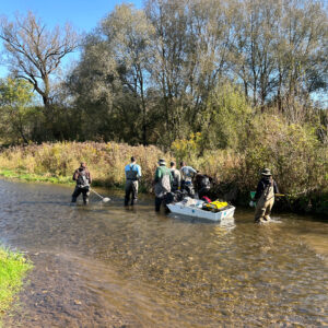
While human infrastructure, urbanization, and industrialization have advanced human societies, the natural environment has suffered due to constructed impediments and deteriorating architecture. In order to combat this degradation, habitat restoration programs across the US work to remove impairments and improve damaged waterways. [caption id="attachment_39162" align="aligncenter" width="940"] Barge electrofishing by state and federal employees prior to habitat restoration on Wiscoy Creek which is a tributary to the Genesee River. (Credit Thomas Hoffman)[/caption] Habitat Restoration Efforts in the Great Lakes Tom Hoffman, aquatic habitat restoration biologist in the Lower Great Lakes basin, directs restoration efforts within tributaries to Lake Erie, Lake Ontario, and the St.
Read MoreSustainable Fishing in Alaska: Protecting the Salmon Capital of the World through Research
In the far north, the Alaska Peninsula stretches away from the Last Frontier into the Pacific Ocean. A narrow strip of land dotted with freshwater lakes and intruded upon by ocean inlets–this unique region is intimately connected with the surrounding water. Nestled halfway down the peninsula's southern coast are the small villages of Chignik. The area has historically been home to the Aleut people and has been heavily reliant on fishing for centuries. Home to commercial and subsistence fishing today, Chignik continues to rely upon the salmon returns to the surrounding villages, which are supported by scientists working tirelessly to understand and steward these fish populations.
Read MoreNexSens X3 Data Logger Review
Extreme environments meet extreme design with the NexSens X3 Data Logger . The new logger offers the latest in real-time monitoring technology with wireless communication, a large plug-and-play sensor library and ultra-low power consumption, all in a waterproof marine-grade housing. The X3 is built to handle harsh weather, floods, high winds and rough seas, and it stands alone; no additional protective housing needed. With an operating temperature that ranges from -40°C to 70°C, the logger can withstand arctic environments and extreme heat. A conformal coating on the internal circuit board isolates it from moisture and humidity.
Read More


