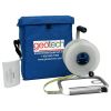
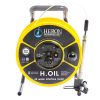
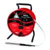
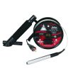
Geotech Oil/Water Interface Meters
Features
- Extremely durable polypropylene storage reel with rugged aluminum frame
- Highly accurate Kynar coated steel tape marked in engineering or metric units
- Field replaceable probe is only 5/8" in diameter
- Free ground shipping
- Expedited repair and warranty service
- Lifetime technical support
- More
Overview
The Geotech Interface Meter can be used in numerous applications including measuring oil and water levels in monitoring wells, detecting tank leakage and obtaining accurate measurements of water levels. When the Geotech Interface Meter is lowered down a well and contacts the product layer, a solid tone and green light alarm is activated on the reel. When the probe detects water, the tone begins to oscillate and the light changes to green.
Benefits
- Extremely durable polypropylene storage reel with rugged aluminum frame
- Highly accurate Kynar coated steel tape marked in engineering or metric units
- Field replaceable probe is only 5/8"" in diameter
- Stainless Steel conductors for durability
- FEP and stainless steel probe with Viton strain relief
- Audible and visible alarms activated on reel when probe contacts product and water
- Auto shut-off circuit to extend battery life
- Easily replaced 9 volt battery
- Water-resistant padded carrying case to protect instrument
- Built-in reel hanger for longer tape life
- (1) Interface meter
- (1) Carrying case
- (1) Operations manual
In The News
Spring 2025 Environmental Monitor Available Now
In the Spring 2025 edition of the Environmental Monitor, we highlight partnerships across the world and the importance of collaboration between government agencies, universities, environmental groups, local communities, and other stakeholders. From great white shark research in Cape Cod to monitoring fisheries in Lake Erie, this latest edition underscores partnerships that connect stakeholders in a watershed through environmental data. With an emphasis on data sharing, a combination of real-time and discrete sampling keeps the public and partners informed of environmental conditions. Our writers also sought out science professionals dedicated to working with peers within and outside of the environmental sector.
Read MoreMonitoring Mariculture in the Gulf of Alaska
The mariculture industry in the Gulf of Alaska has been steadily growing in recent years, guided by ongoing research to help refine farm location and cultivation practices. A subset of aquaculture, mariculture focuses on rearing organisms in the open ocean. In Alaska, finfish farming is illegal, so most farms cultivate kelp, oysters, or a combination of the two. These small, locally operated farms started popping up in the Gulf of Alaska in the early 1990s, when shellfish farming first became legal. Kelp farming did not begin to catch on in the state until 2016. Many of the coastal areas that have grown interested in mariculture are historically commercial fishing communities.
Read MoreSupplying Seattle’s Drinking Water: Using Data Buoys to Monitor the Cedar River Municipal Watershed
Providing clean, safe, and reliable drinking water for the 1.6 million people in the greater Seattle area is a top priority for Seattle Public Utilities (SPU). With limited water supplies, SPU dedicates considerable resources to maintain its watersheds and mountain reservoirs. About 70 percent of Seattle Water comes from the Cedar River Municipal Watershed , and the other 30 percent comes from the South Fork Tolt River Watershed . [caption id="attachment_39574" align="alignnone" width="940"] Data buoy in Chester Morse Lake . (Credit: Kevin Johnson / Seattle Public Utilities) [/caption] Jamie Thompson, a fisheries biologist at SPU, monitors aquatic ecosystems centered on fish listed under the U.S. Endangered Species Act (ESA).
Read More


