
Heron dipperLog 128+ Water Level Logger
Features
- Built-in battery & data logger with 128,000 data set memory
- Barometric pressure can be compensated using barLog
- Easy-to-use software for deployment, data upload & data management
- Free ground shipping
- Expedited repair and warranty service
- Lifetime technical support
- More
Overview
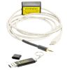
The Heron dipperLog 128+ is a highly accurate groundwater data logger used by hydrogeologists, hydrologists, environmental technicians, water well contractors and other groundwater professionals. The dipperLog 128+ is a reliable and cost-effective solution for long and short-term monitoring of groundwater levels and temperature in wells, boreholes and open bodies of water.
Mechanics
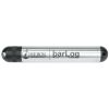
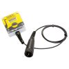
The Heron Instruments barLog, barometric logger is used to automatically compensate readings stored on the dipperLog for changes in barometric pressure. The barLog, with readings every 1 hour and a memory capacity of 128,000 data points, is recommended for long-term monitoring or where more than one logger is deployed within a 5 km radius.
Select Options


In The News

Floating Global New Ideas: Buoy-Enabled Research at Florida Agricultural and Mechanical University’s School of the Environment
Florida Agricultural and Mechanical University (FAMU), based in Tallahassee, Florida, is the highest-rated public Historically Black College or University in the United States. FAMU’s School of the Environment (FAMU-SOE) offers BS and BA degrees in Environmental Studies, and BS, MS, and Ph.D. degrees in Environmental Science, with specialisms available in areas including Environmental Policy and Risk Management, Aquatic and Terrestrial Ecology, and Biomolecular Sciences. In 2021, FAMU-SOE deployed a NexSens CB-450 buoy in Apalachee Bay, a key oyster farming area around 30 miles south of Tallahassee. The buoy has quickly been incorporated into the curriculum, providing environmental insights for student research, the community, and beyond. Dr.
Read More
Monitoring Habitat Suitability and Water Quality in Northwest Arkansas Springs
Northwest Arkansas has seen an economic, industrial, and population boom in recent years as a result of expanding businesses, which have created thousands of jobs in the region and the mass migration of employees and construction companies. However, with this growth has come rapid urbanization and the degradation of the natural landscape, specifically the freshwater springs that can be found throughout the region. These springs are critical habitat centers for native wildlife, home to threatened and endangered fish, and those that have yet to be listed. Zach Moran, Assistant Professor of Fisheries Science at Arkansas Technical University, is working to help monitor these habitats and provide key data that will hopefully inform future development in the region.
Read More
Three Decades of Research at Acton Lake
A multi-disciplinary team at Miami University, Ohio, has been studying the environmental change at Acton Lake for over three decades. Using three different NexSens buoys over this time, the team has an incredible archive of data that is helping build a picture of Acton’s past, present, and future. Until recently, a NexSens CB-50 buoy was used alongside other environmental monitoring at Acton Lake. In May 2025, the Miami team deployed a new XB-200 buoy , future-proofing their ongoing monitoring using real-time buoy systems. Acton Lake, a small hypereutrophic reservoir in southwest Ohio, covers 2.4km² and has a maximum depth of about 8m. The dam was built in 1956, and the lake has a large agricultural watershed.
Read More