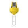
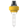
NexSens CB-75 Data Buoy
Features
- Optimized for X3-SUB data logger with available 4G cellular or Iridium satellite telemetry
- Available with solar or blank top depending on battery type used in data logger
- Topside plate supports solar marine light, weather stations, and other sensors
- Expedited repair and warranty service
- Lifetime technical support
- More
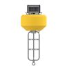
The CB-75 Data Buoy is a compact, affordable, and easy to deploy platform for both water and atmospheric observations. At 21” (53.34cm) hull diameter and 40 lb. (18.14kg) weight, it’s ideally suited for tethered moorings. The buoy is designed to integrate the X3-SUB Submersible Data Logger, which includes external sensor ports to support weather stations, thermistor strings, multi-parameter sondes, Doppler current profilers, GPS, and other monitoring instruments.
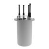
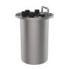
Constructed of an inner core of cross-linked polyethylene foam with a tough polyurea skin, the CB-75 is designed for years of service. Select from a solar top with rechargeable battery pack for long-term deployments or a blank top with alkaline battery pack for short-term or seasonal applications. All electronics are housed in a quick-removable X3-SUB data logger package with wet-mateable connectors. A removeable instrument cage serves as counter-ballast and supports instrument mounting, while three 1.5” (3.81cm) pass-through holes facilitate cable routing of underwater sensors.
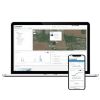
Available with integrated 4G LTE or Iridium satellite communications, the CB-75 Data Buoy sends data in real-time to the cloud-based WQData LIVE datacenter. In the Basic tier, this free service allows users to securely access and analyze data, as well as share data through an auto-report. Subscription-based tiers of WQData LIVE are also available for generating custom alarms, exporting data through an API or custom NDBC/GLOS formats, and providing a publicly-accessible version of the project website.
Hull Outer Diameter: 21” (53.34cm)
Hull Height: 13” (33.02cm)
Center Hole Inner Diameter: 5.5” (13.97cm)
Center Hole Height: 13" (33.02cm)
Pass-Through Hole Diameter: 1.5" (3.81cm)
Tower Height: 8.2” (20.83cm)
Solar Panels: 3x 4-watts (CB-75 only)
Weight: 28 lb. (12.70kg); 40 lb. (18.20kg) with X3-SUB
Net Buoyancy: 75 lb. (34.00kg)
Hull Material: Cross-linked polyethylene foam with polyurea coating & stainless steel deck
Hardware Material: 316 stainless steel, 304 stainless steel (lifting handles)
Tethering Attachments: 3x 3/8” eye nuts
In The News
Protecting Chicago's Lakefront: Freshwater Beach Monitoring
Thousands of people flock to the Great Lakes every year to enjoy the freshwater beaches along the coast. As an urban hub with over 2.5 million residents, beachfronts in Chicago have regular visitors as well as tourists that recreate in the bordering Lake Michigan. According to the Chicago Park District, it is estimated that more than 100,000 residents and visitors per day use Chicago’s Lakefront trail during summer weekends. Proximity to the Lake is not only a recreational activity for Chicagoans, but also a part of the city’s history due to its role in domestic and international shipping routes. In addition, the Lake serves as a drinking water source and as an essential climate regulator in the region that acts as a natural air conditioning affect.
Read MoreMonitoring Mariculture in the Gulf of Alaska
The mariculture industry in the Gulf of Alaska has been steadily growing in recent years, guided by ongoing research to help refine farm location and cultivation practices. A subset of aquaculture, mariculture focuses on rearing organisms in the open ocean. In Alaska, finfish farming is illegal, so most farms cultivate kelp, oysters, or a combination of the two. These small, locally operated farms started popping up in the Gulf of Alaska in the early 1990s, when shellfish farming first became legal. Kelp farming did not begin to catch on in the state until 2016. Many of the coastal areas that have grown interested in mariculture are historically commercial fishing communities.
Read MoreSupplying Seattle’s Drinking Water: Using Data Buoys to Monitor the Cedar River Municipal Watershed
Providing clean, safe, and reliable drinking water for the 1.6 million people in the greater Seattle area is a top priority for Seattle Public Utilities (SPU). With limited water supplies, SPU dedicates considerable resources to maintain its watersheds and mountain reservoirs. About 70 percent of Seattle Water comes from the Cedar River Municipal Watershed , and the other 30 percent comes from the South Fork Tolt River Watershed . [caption id="attachment_39574" align="alignnone" width="940"] Data buoy in Chester Morse Lake . (Credit: Kevin Johnson / Seattle Public Utilities) [/caption] Jamie Thompson, a fisheries biologist at SPU, monitors aquatic ecosystems centered on fish listed under the U.S. Endangered Species Act (ESA).
Read More


