NexSens WQData LIVE Web Datacenter
Features
- 2-way communication with remote systems
- Interactive ESRI Leaflet map interface
- View & download tabular and graphical data
- Expedited repair and warranty service
- Lifetime technical support
- More
WQData LIVE is a web-based project management service that allows users 24/7 instant access to data collected from remote telemetry systems. Users with NexSens X-Series data logger platforms have the ability to configure and update systems remotely via Wi-Fi, cellular or satellite telemetry. All projects are password-protected with multi-level access. Administrators have full access for remote communication and project modification, while collaborators are limited to viewing and exporting data.
The online database offers the ability to view live readings, configure alerts to notify project personnel when data values exceed threshold limits, export data and more. The project dashboard includes a ESRI Leaflet map view showing all project sites on a map with zoom, scroll and drag capability. The bottom of the dashboard includes a project overview, data disclaimer and project photo. For projects with multiple locations, each site within a project shows the data loggers connected along with a site photo in a convenient viewing pane.
Clicking on any site within a project displays the most recent data values alongside a graph depicting a day, week, month or year of data. Within each parameter, users can register to receive alerts via email based on a high or low threshold. A rich set of meta data and diagnostic data specific to each site is displayed at the bottom for troubleshooting sensor or data logger issues. With this rich set of tools, WQData LIVE simplifies the task of managing an environmental monitoring project.
In The News
Expanding the Port Everglades: Real-Time Monitoring of Water Quality Conditions from Planned Dredging Operation
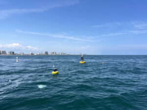
The Port Everglades in Broward County, Florida, serves large trade vessels and cruiseliners and incoming and outgoing recreational boaters. However, as cargo ships become larger, the port must expand. A dredging project led by the US Army Corps of Engineers will substantially deepen and widen the port's navigation channel to accommodate larger Panamax cargo ships and modern cruise liners. As a result of this project, a large amount of sediment will be displaced into the water column. This suspended sediment may settle outside of the project area, burying benthic organisms like corals, and possibly carrying harmful particulates to other regions. [caption id="attachment_39497" align="aligncenter" width="2560"] A CB-950 and CB-25 deployed on site at Port Everglades.
Read MoreMonitoring Meadowbrook Creek: Real-Time Data Collection in an Urban Creek
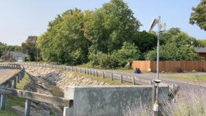
Meadowbrook Creek in Syracuse, New York, has been monitored by Syracuse University (SU) faculty and students for over a decade. Originally established by Dr. Laura Lautz in 2012, the early years of the program focused on collecting grab water samples for laboratory analysis and evaluating the impact of urban land use, human activities, and natural processes on water resources. Tao Wen , an Assistant Professor in SU’s Department of Earth and Environmental Sciences, took over the program in 2020 and upgraded the existing systems to include 4G modems that allowed for real-time data viewing. [caption id="attachment_39339" align="alignnone" width="940"] An overview of the Fellows Ave monitoring station along Meadowbrook Creek.
Read MoreLancaster County Makes the Switch to Real-Time Water Quality Monitoring Systems
Continuous data collection in Lancaster County, Pennsylvania, started about 5 years ago, and the county will be making a major upgrade over the next year—switching from relying solely on the internal storage of water quality sondes to telemetry units that enable real-time data viewing. [caption id="attachment_39295" align="alignnone" width="940"] The first telemetry unit was installed at LCCD along Little Conestoga Creek. (Credit: Tyler Keefer / LCCD) [/caption] Telling Lancaster County's Story Through Data Since the Lancaster County Conservation District started monitoring county waterways, the goal has remained the same, according to Amanda Goldsmith, Watershed Specialist for the Watershed Department.
Read More


