
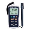
Onset HOBO MX Carbon Dioxide/Temp/RH Data Logger
Features
- Measurement range, 0-5,000 ppm
- Self-calibrating NDIR CO2 sensor technology
- Access data by mobile phone, tablet or computer within 100ft of logger
- Expedited repair and warranty service
- Lifetime technical support
- More
Overview
The Onset HOBO MX1102 CO2 logger makes it more convenient than ever to measure and record CO2 in buildings and other non-condensing environments. It measures CO2 from 0–5,000 parts per million (ppm). The free HOBOconnect app allows users to access data right from a mobile phone or tablet within a 100-foot range. Remotely access data in Onset’s cloud-based HOBOlink software with the new MX Gateway.
Mechanics
The MX1102 also features a USB port, so it can be used with a computer running HOBOware Pro graphing and analysis software.
| Temperature Sensor | |
| Range | 0° to 50°C (32° to 122°F) |
| Accuracy | ±0.21°C from 0° to 50°C (±0.38°F from 32° to 122°F) |
| Resolution | 0.024°C at 25°C (0.04°F at 77°F) |
| Drift | <0.1°C (0.18°F) per year |
| RH Sensor | |
| Range |
1% to 90% RH (non-condensing) |
| Accuracy | ±2% from 20% to 80% typical to a maximum of ±4.5% including hysteresis at 25°C (77°F); below 20% and above 80% ±6% typical |
| Resolution | 0.01% |
| Drift | <1% per year typical |
| CO2 Sensor | |
| Range | 0 to 5,000 ppm |
| Accuracy |
±50 ppm ±5% of reading at 25°C (77°F), less than 90% RH non-condensing and 1,013 mbar |
| Warm-up Time | 15 seconds |
| Calibration | Auto or manual to 400 ppm |
| Non-linearity | <1% of FS |
| Pressure Dependence | 0.13% of reading per mm Hg (corrected via user input for elevation/altitude) |
| Operating Pressure Range | 950 to 1,050 mbar (use Altitude Compensation for outside of this range) |
| Compensated Pressure Range | -305 to 5,486 m (-1,000 to 18,000 ft) |
| Sensing Method | Non-dispersive infrared (NDIR) absorption |
| Response Time | |
| Temperature | 12 minutes to 90% in airflow of 1 m/s (2.2 mph) |
| RH | 1 minute to 90% in airflow of 1 m/s (2.2 mph) |
| CO2 | 1 minute to 90% in airflow of 1 m/s (2.2 mph) |
| Logger | |
| Radio Power | 1 mW (0 dBm) |
| Transmission Range | Approximately 30.5 m (100 ft) line-of-sight |
| Wireless Data Standard | Bluetooth Smart (Bluetooth Low Energy, Bluetooth 4.0) |
| Logger Operating Range | 0° to 50°C (32° to 122°F); 0 to 95% RH (non-condensing) |
| Logging Rate | 1 second to 18 hours |
| Logging Modes | Fixed interval (normal, statistics) or burst |
| Memory Modes | Wrap when full or stop when full |
| Start Modes | Immediate, push button, date & time, or next interval |
| Stop Modes | When memory full, push button, date & time, or after a set logging period |
| Time Accuracy | ± 1 minute per month at 25°C (77°F) |
| Power Source | 4 AA 1.5 Volt batteries (user replaceable) or USB power source (5 V DC, 2 Watts) |
| Battery Life | 6 months, typical with logging and sampling intervals of 5 minutes or slower; 6 months or less with logging and sampling intervals faster than 5 minutes while logging CO2. Entering burst logging mode will impact battery life. With app use, battery life can be reduced by remaining connected, excessive readouts, audible alarms, and paging. Visual/audible alarms and other events can have a marginal impact on battery life. |
| Memory | 128 KB (84,650 measurements, maximum) |
| Download Type | USB 2.0 interface or via Bluetooth Smart |
| Full Memory Download Time | 20 seconds via USB; approximately 60 seconds via Bluetooth Smart, may take longer the further the device is from the logger |
| LCD | LCD is visible from 0° to 50°C (32° to 122°F); the LCD may react slowly or go blank in temperatures outside this range |
| Size | 7.62 x 12.95 x 4.78 cm (3.0 x 5.1 x 1.88 inches) |
| Weight | 267.4 g (9.43 oz) |
| Environmental Rating | IP50 |
- HOBO MX1102 CO2 Data Logger
- Four AA 1.5 V alkaline batteries
Select Options


In The News

Save our Bogs! Culture, Conservation and Climate Action in Ireland’s Peatlands
Characterized by long-term accumulation under waterlogged conditions, peatlands exist on every continent and account for 3-4% of the global land surface . Small but mighty, these often overlooked wetland environments are estimated to hold as much as one-third of the world's organic carbon in their soil—twice the amount found in the entirety of the Earth's forest biomass. While healthy peatlands can trap and store carbon, regulate water, and provide important habitats for rare species, human alteration has disturbed peatland carbon and nitrogen cycles on a global scale. Approximately 12% of the world’s peatlands have been drained and degraded through conversion for agriculture, forestry, infrastructure development, and other uses.
Read More
Sargassum Surge: How Seaweed is Transforming our Oceans and Coastal Ecosystems
Until recently, Sargassum –a free-floating seaweed–was distributed throughout the Sargasso Sea , the north Caribbean Sea, and the Gulf of Mexico. But in the space of a decade, this seaweed has, as one scientist remarks , “Gone from a nonfactor to the source of a terrible crisis.” Driven by climate change, anomalous North Atlantic Oscillation in 2009-2010 and a glut of anthropogenic pollutants, sargassum has proliferated. Seasonally recurrent mats as deep as 7m now bloom in the “Great Atlantic Sargassum Belt” (GASB), which covers areas of the Atlantic from West Africa to the Caribbean Sea and Gulf of Mexico. Every year, millions of tons wash up along the shores of more than 30 countries . Dr.
Read More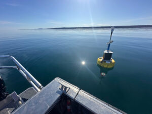
Great Lakes Research Center: Designing Targeted Monitoring Solutions
According to the National Oceanic and Atmospheric Administration ( NOAA ), the Great Lakes have more miles of coastline than the contiguous Atlantic and Pacific coasts combined and contain 20 percent of the world's freshwater, making it a critical region to protect and conserve. Continuous monitoring and data-informed resource management are key components of managing waters in the region. Hayden Henderson, a research engineer with the Great Lakes Research Center (GLRC), designs and deploys monitoring platforms throughout the Great Lakes. With a background in environmental engineering, Henderson enjoyed the challenge of creating systems and making them work to obtain difficult, remote measurements.
Read More