
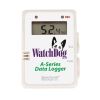
Onset HOBO MX Temperature Data Logger
Features
- Set up and offload loggers wirelessly from your mobile device or Windows computer
- Splash-proof design enables use in damp environments and spray-down applications
- Visual alarms on the logger display and mobile app keep you notified of problems
- Expedited repair and warranty service
- Lifetime technical support
- More
Overview
The Onset HOBO MX100 is a low-cost, splash-proof, Bluetooth-enabled data logger that measures and transmits temperature data wirelessly to mobile devices or Windows computers. The HOBO MX100 data logger requires a compatible mobile device or Windows computer running the HOBOconnect app.
Deployment
Ideal for a range of indoor monitoring applications, this self-contained wireless data logger lets you configure it and access temperature data at any time when within a 100-foot range, with no dedicated equipment beyond a mobile device or Windows computer running the HOBOconnect app.
|
Temperature Sensor |
|
|
Range |
-30° to 70°C (-22° to 158°F) |
|
Accuracy |
±1.0°C from -30° to -5°C (±1.8°F from -22° to 23°F) |
|
Resolution |
0.04°C (0.072°F) |
|
Drift |
<0.01°C (0.018°F) per year |
|
Response Time |
6 minutes typical to 90% in open air moving 1 m/s, unmounted |
|
Logger |
|
|
Logger Operating Range |
-30° to 70°C (-22° to 158°F) |
|
Radio Power |
1 mW (0 dBm) |
|
Transmission Range |
Approximately 30.5 m (100 ft) line-of-sight |
|
Wireless Data Standard |
Bluetooth Smart (Bluetooth Low Energy) |
|
Logging Rate |
1 second to 18 hours |
|
Time Accuracy |
± 1 minute per month at 25°C (77°F) |
|
Battery |
CR2450 3V lithium, not replaceable |
|
Battery Life |
1 year, typical with logging interval of 1 minute and Power Saving Mode disabled; 2 years, typical with logging interval of 1 minute and Power Saving Mode enabled. Faster logging intervals, remaining connected with the app, excessive downloads, and paging may impact battery life. |
|
Memory |
30,000 Measurements |
|
Full Memory Download Time |
Approximately 30 seconds; may take longer the farther the device is from the logger |
|
Dimensions |
6.9 x 4.5 x 1.1 cm (2.71 x 1.76 x 0.42 inches) |
|
Weight |
25.5 g (0.90 oz) |
|
Environmental Rating |
IP67 |
Select Options


In The News

Data-Driven Advocacy on the Lower Deschutes River
Like many freshwater environments, the Deschutes River in Oregon is under pressure from development, pollution, and climate change. Many rivers, streams and lakes in the Deschutes Basin do not meet Oregon water quality standards –where state water quality monitoring assesses levels of bacteria, pH, dissolved oxygen, temperature, and fine sediment. Hannah Camel is the Water Quality Coordinator for the Deschutes River Alliance (DRA), a non-profit organization that focuses on the health of the lower 100 miles of the Deschutes River–the area most affected by human intervention. As a data-driven organization, the DRA has benefited from the installation of two NexSens X2 data loggers.
Read More
Expanding the Port Everglades: Real-Time Monitoring of Water Quality Conditions from Planned Dredging Operation
The Port Everglades in Broward County, Florida, serves large trade vessels and cruiseliners and incoming and outgoing recreational boaters. However, as cargo ships become larger, the port must expand. A dredging project led by the US Army Corps of Engineers will substantially deepen and widen the port's navigation channel to accommodate larger Panamax cargo ships and modern cruise liners. As a result of this project, a large amount of sediment will be displaced into the water column. This suspended sediment may settle outside of the project area, burying benthic organisms like corals, and possibly carrying harmful particulates to other regions. [caption id="attachment_39497" align="aligncenter" width="2560"] A CB-950 and CB-25 deployed on site at Port Everglades.
Read More
It’s Time to React to Water Quality: Proteus Multiparameter Probe aboard NexSens Buoy
Water quality monitoring is essential for safeguarding public health, protecting ecosystems, and ensuring the sustainability of water resources. Contaminants such as industrial pollutants, agricultural runoff, and sewage discharge can severely impact aquatic life and pose serious risks to human health if left unchecked. Traditionally, water quality monitoring has been a slow and labor-intensive process, requiring samples to be collected, transported to a lab, and analyzed—a process that can take days. However, with the advancement of real-time sensor technology, environmental agencies, researchers, and industries can now monitor water quality instantly.
Read More