
HOBO MX800 Series Water Data Loggers
Features
- Submersible and direct read options available
- Wireless data offload via Bluetooth 5.0 and HOBOconnect mobile app
- Water detect feature indicates when logger was out of the water
- Free ground shipping
- Expedited repair and warranty service
- Lifetime technical support
- More
Overview
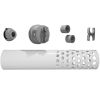
HOBO MX800 Series wireless data loggers work with interchangeable sensors to provide a highly configurable solution for monitoring water conductivity/salinity, temperature, level, and dissolved oxygen. Available in both an easy-to-deploy, fully submersible model (MX801) and a direct read model (MX802) for convenient data offload that doesn’t require having to remove sensors from the water.
Features
- Compatible with interchangeable Conductivity, CTD (conductivity/temperature/depth), and DO sensors (sold separately) - swap out sensors for different applications
- Bluetooth, for easy logger configuration and data offload
- Easy to deploy, fully submersible (MX801)
- Direct read for convenient data offload (MX802)
- Logger diameter is less than 2 inches
- Faster data offload via Bluetooth 5.0
- Water detect feature indicates when logger was out of the water (MX801)
- Barometric pressure sensor included (MX802)
- Connect two sensors to one logger to get measurements like salinity adjusted DO directly, with no need for post processing
- Guided calibration ensures accurate data
- User-replaceable batteries
| MX801 and MX802 | |
| Operating Range | -40° to 50°C (-40° to 122°F), cannot be frozen in ice |
| Radio Power | 1 mW (0 dBm) |
| Transmission Range | Approximately 30.5 m (100 ft) line-of-sight |
| Wireless Data Standard | Bluetooth 5 |
| Maximum Number of Sensors | 2 |
| Maximum Cable Length | 120m (400 ft) |
| Logging Rate | 5 second to 18 hours |
| Logging Modes | Fixed interval (normal or statistics), burst, or multiple intervals with up to 8 user-defined logging intervals and durations, with pause and repeat options |
| Start Modes | Immediate, next interval or date & time |
| Stop Modes | Memory full, never stop (overwrite oldest data), date & time, or after a set logging period |
| Water Detect | Events are logged when logger is submerged or removed from the water (MX801 only) |
| Time Accuracy | ±1 minute per month 0° to 50°C (32° to 122°F) |
| Battery | Four AA, 1.5 V lithium batteries, user replaceable |
| Battery Life | With W-CTD or W-CT sensors: 2 years, typical with 1-minute logging interval or slower |
| With W-DO sensor: 1-year, typical with 5-minute logging interval or slower | |
| Faster logging or statistics sampling intervals, entering burst logging mode, excessive readouts, and remaining connected with the app will impact battery life | |
| Memory | 730,000 measurements, divided between channels (4 Mbyte memory) |
| Data Download Time (Bluetooth 5) | Full memory: Approximately 3.5 minutes |
| 120,000 measurements: 1 minute | |
| May take longer the further the device is from the logger | |
| Dimensions | Logger diameter: 4.14 cm (1.63 inches) |
| Length without sensor: 20 cm (8 inches) | |
| Length with W-CTD sensor: 36 cm (14 inches) | |
| Length with W-CT sensor: 33 cm (13 inches) | |
| Mounting loop: 12.7 x 22.6 mm (0.5 x 0.89 inches) | |
| Weight | Approximately xx g (xx oz) in air; approximately xx g (xx oz) in saltwater |
| Wetted Materials | Logger: PVC housing with polyester film label, PET sensor connector end cap and mounting handle with EPDM and Buna-N O-rings, passivated 316 stainless steel hardware rated for use in saltwater; MX802 also has ePTFE vent |
| Collar: HDPE, titanium screws | |
| Note: logger should be mounted so that no metal parts of the logger are in contact with other metals | |
| Environmental Rating | MX801: IP68; waterproof to 100m (with sensor(s) attached) |
| MX802: IP67, NEMA 6; Weatherproof (with cable or Termination Plug attached); this model is not waterproof | |
| MX802 Barometric Pressure | |
| Measurement & Calibrated Range | 66 to 107 kPa (9.6 to 15.5 psia), -20° to 50°C (-4° to 122°F) |
| Accuracy* | Typical error: ±0.2 kPa (0.029 psi) |
| Maximum error: ±0.5 kPa (0.073 psi) | |
| Resolution | <0.01 kPa (0.0015 psi) |
| Pressure Response Time** | <1 second to 90% at a stable temperature |
| Contribution to Water Level Accuracy*** | Typical error: ±0.075% FS, 0.3 cm (0.01 ft) water |
| Maximum error: ±0.15% FS, 0.6 cm (0.02 ft) water | |
| *Pressure Accuracy: Absolute pressure sensor accuracy includes all sensor drift, temperature, and hysteresis-induced errors. | |
| **Changes in Temperature: Allow 20 minutes in water to achieve full temperature compensation of the pressure sensor. There can be up to 0.5% of additional error due to rapid temperature changes. | |
| ***Water Level Accuracy: With accurate reference water level measurement, known for water density, and a stable temperature environment. System Water Level Accuracy equals the sum of the Barometric Water Level Accuracy plus the selected CTD sensor Water Level Accuracy. | |
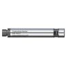
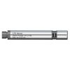
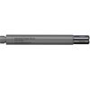
- (1) HOBO MX800 data logger
- (1) Coupler
- (1) 3/32" Allen wrench
Select Options


In The News

Three Decades of Research at Acton Lake
A multi-disciplinary team at Miami University, Ohio, has been studying the environmental change at Acton Lake for over three decades. Using three different NexSens buoys over this time, the team has an incredible archive of data that is helping build a picture of Acton’s past, present, and future. Until recently, a NexSens CB-50 buoy was used alongside other environmental monitoring at Acton Lake. In May 2025, the Miami team deployed a new XB-200 buoy , future-proofing their ongoing monitoring using real-time buoy systems. Acton Lake, a small hypereutrophic reservoir in southwest Ohio, covers 2.4km² and has a maximum depth of about 8m. The dam was built in 1956, and the lake has a large agricultural watershed.
Read More
Source Water Monitoring in Albany, New York: Tracing Water Quality throughout Tributaries
Thousands of US cities pull their drinking water from natural source waters like reservoirs, rivers, and streams, making overall watershed health a key consideration for water providers. In Albany, New York, the Albany Department of Water and Water Supply delivers drinking water to over 100,000 residents as well as monitors and manages the larger drinking water supply watershed. Hannah Doherty, Environmental Specialist at the Albany Department of Water and Water Supply , spends her days working with a small team to monitor the drinking supply and the connected water bodies. Doherty explains, “We’re the first to encounter the water that ends up being the drinking water.
Read More
Wildfire Prevention in the Sierra Nevada Region with the Yuba Watershed Institute
Though recent wildfires have sparked new conversations about wildfire management and response, groups like the Yuba Watershed Institute have been monitoring the forests and water resources of the Sierra Nevada region for decades, managing approximately 5,000 acres of land with the Bureau of Land Management (BLM) and about 7,000 acres in private land partnerships. The goal of the Institute is to work with local communities and land agencies to improve watershed and forestry management through informed practices and public outreach. The goals of the Yuba Watershed Institute are three-fold: Improve the ability of fire suppression agencies like the California Department of Forestry and Fire Protection ( CAL FIRE ) and the US Forest Service.
Read More