
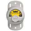
Onset HOBO TidbiT v2 Temperature Logger
Features
- Onset's smallest temperature data logger (3x4 cm)
- Waterproof to 300 meters (1,000 feet)
- Data readout in less than 30 seconds via fast Optic USB interface
- Expedited repair and warranty service
- Lifetime technical support
- More
Overview
The Onset HOBO TidbiT v2 Temperature Logger measures temperatures over a wide temperature range in outdoor and underwater environments. The TidbiT v2 provides 12-bit resolution and has ±0.2 °C accuracy. It is designed for outdoor and underwater environments and is waterproof to 300m (1000 ft). An optical USB interface allows users to offload data in seconds.
*Please note: A solar radiation shield is required to obtain accurate air temperature measurements in sunlight (RS1 Solar Radiation Shield, assembly required; or M-RSA pre-assembled Solar Radiation Shield).
Temperature Sensor
Operation range:* -20° to 70°C (-4° to 158°F) in air; maximum sustained temperature of 30°C (86°F) in water*
Accuracy: ±0.21°C from 0° to 50°C (±0.38°F from 32° to 122°F)
Resolution: 0.02°C at 25°C (0.04°F at 77°F)
Response time: 5 minutes in water; 12 minutes in air moving 2 m/sec; 20 minutes in air moving 1 m/sec (typical to 90%)
Stability (drift): 0.1°C (0.18°F) per year
Logger
Real-time clock: ± 1 minute per month 0° to 50°C (32° to 122°F)
Battery: 3 Volt lithium, non-replaceable
Battery life (typical use): 5 years with 1 minute or greater logging interval
Memory (non-volatile): 64K bytes memory (approx. 42,000 12-bit temperature measurements)
Weight: 19.6 g (0.69 oz)
Dimensions: 3.0 × 4.1 × 1.7 cm (1.2 × 1.6 × 0.68 in.); mounting bail 4.6 mm (3/16 in.) diameter hole
Wetted materials: Epoxy case
Waterproof: To 305 m (1000 ft.)
Logging interval: Fixed-rate or multiple logging intervals, with up to 8 user-defined logging intervals and durations; logging intervals from 1 second to 18 hours. Refer to HOBOware software manual.
Launch modes: Immediate start, delayed start
Offload modes: Offload while logging; stop and offload
Battery indication: Battery level can be viewed in status screen and optionally logged in datafile. Low battery indication in datafile.
Environmental Rating: IP68
NIST certificate: Available for additional charge
* To guarantee accuracy, the TidbiT v2 Temp must not be used in condensing environments and water temperatures higher than 30C (86F) for more than eight cumulative weeks over the life of the logger. Frequent or prolonged exposure will lead to measurement drift and eventual failure.
Select Options


In The News

Save our Bogs! Culture, Conservation and Climate Action in Ireland’s Peatlands
Characterized by long-term accumulation under waterlogged conditions, peatlands exist on every continent and account for 3-4% of the global land surface . Small but mighty, these often overlooked wetland environments are estimated to hold as much as one-third of the world's organic carbon in their soil—twice the amount found in the entirety of the Earth's forest biomass. While healthy peatlands can trap and store carbon, regulate water, and provide important habitats for rare species, human alteration has disturbed peatland carbon and nitrogen cycles on a global scale. Approximately 12% of the world’s peatlands have been drained and degraded through conversion for agriculture, forestry, infrastructure development, and other uses.
Read More
Sargassum Surge: How Seaweed is Transforming our Oceans and Coastal Ecosystems
Until recently, Sargassum –a free-floating seaweed–was distributed throughout the Sargasso Sea , the north Caribbean Sea, and the Gulf of Mexico. But in the space of a decade, this seaweed has, as one scientist remarks , “Gone from a nonfactor to the source of a terrible crisis.” Driven by climate change, anomalous North Atlantic Oscillation in 2009-2010 and a glut of anthropogenic pollutants, sargassum has proliferated. Seasonally recurrent mats as deep as 7m now bloom in the “Great Atlantic Sargassum Belt” (GASB), which covers areas of the Atlantic from West Africa to the Caribbean Sea and Gulf of Mexico. Every year, millions of tons wash up along the shores of more than 30 countries . Dr.
Read More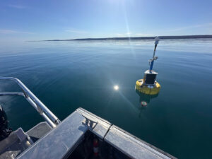
Great Lakes Research Center: Designing Targeted Monitoring Solutions
According to the National Oceanic and Atmospheric Administration ( NOAA ), the Great Lakes have more miles of coastline than the contiguous Atlantic and Pacific coasts combined and contain 20 percent of the world's freshwater, making it a critical region to protect and conserve. Continuous monitoring and data-informed resource management are key components of managing waters in the region. Hayden Henderson, a research engineer with the Great Lakes Research Center (GLRC), designs and deploys monitoring platforms throughout the Great Lakes. With a background in environmental engineering, Henderson enjoyed the challenge of creating systems and making them work to obtain difficult, remote measurements.
Read More