
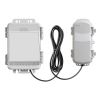
HOBOnet Wireless 10HS Soil Moisture Sensor
Features
- 900 MHz wireless mesh self-healing technology
- 450 to 600 meter (1,500 to 2,000 feet) wireless range and up to five hops
- Up to 50 wireless sensors or 336 data channels per HOBO RX station
- Free ground shipping
- Expedited repair and warranty service
- Lifetime technical support
- More
Overview
The Onset HOBOnet Wireless Soil Moisture Sensor integrates the field-proven ECH2O 10HS Sensor and provides readings directly in volumetric water content. The 10cm probes measure soil moisture over a larger volume of soil, helping to average out any soil variability.
Design
The sensor's high-frequency design minimizes sensitivity to salinity and textural effects and gives it a wide measurement range. HOBOnet Wireless Sensors communicate data directly to the HOBO RX3000 or the HOBO MicroRX station or pass data through other wireless sensors back to the central station. They are preconfigured and ready to deploy, and data is accessed through HOBOlink, Onset's innovative cloud-based software platform.
Select Options


In The News

Supplying Seattle’s Drinking Water: Using Data Buoys to Monitor the Cedar River Municipal Watershed
Providing clean, safe, and reliable drinking water for the 1.6 million people in the greater Seattle area is a top priority for Seattle Public Utilities (SPU). With limited water supplies, SPU dedicates considerable resources to maintain its watersheds and mountain reservoirs. About 70 percent of Seattle Water comes from the Cedar River Municipal Watershed , and the other 30 percent comes from the South Fork Tolt River Watershed . [caption id="attachment_39574" align="alignnone" width="940"] Data buoy in Chester Morse Lake . (Credit: Kevin Johnson / Seattle Public Utilities) [/caption] Jamie Thompson, a fisheries biologist at SPU, monitors aquatic ecosystems centered on fish listed under the U.S. Endangered Species Act (ESA).
Read More
Data-Driven Advocacy on the Lower Deschutes River
Like many freshwater environments, the Deschutes River in Oregon is under pressure from development, pollution, and climate change. Many rivers, streams and lakes in the Deschutes Basin do not meet Oregon water quality standards –where state water quality monitoring assesses levels of bacteria, pH, dissolved oxygen, temperature, and fine sediment. Hannah Camel is the Water Quality Coordinator for the Deschutes River Alliance (DRA), a non-profit organization that focuses on the health of the lower 100 miles of the Deschutes River–the area most affected by human intervention. As a data-driven organization, the DRA has benefited from the installation of two NexSens X2 data loggers.
Read More
Expanding the Port Everglades: Real-Time Monitoring of Water Quality Conditions from Planned Dredging Operation
The Port Everglades in Broward County, Florida, serves large trade vessels and cruiseliners and incoming and outgoing recreational boaters. However, as cargo ships become larger, the port must expand. A dredging project led by the US Army Corps of Engineers will substantially deepen and widen the port's navigation channel to accommodate larger Panamax cargo ships and modern cruise liners. As a result of this project, a large amount of sediment will be displaced into the water column. This suspended sediment may settle outside of the project area, burying benthic organisms like corals, and possibly carrying harmful particulates to other regions. [caption id="attachment_39497" align="aligncenter" width="2560"] A CB-950 and CB-25 deployed on site at Port Everglades.
Read More