
HOBOnet Wireless Multi-Depth Soil Moisture Sensor
Features
- 900 MHz wireless mesh self-healing technology
- 450 to 600 meter (1,500 to 2,000 feet) wireless range and up to five hops
- Up to 50 wireless sensors or 336 data channels per HOBO RX station
- Free ground shipping
- Expedited repair and warranty service
- Lifetime technical support
- More
Overview
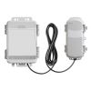
The Onset HOBOnet Multi-Depth Soil Moisture Sensor is a wireless sensor that works with the HOBOnet system to measure soil moisture and soil temperature at multiple depths with a single probe. This durable sensor is available in three probe lengths, for measurements up to 90 cm (35 in) deep.
Mechanics
Featuring GroPoint's TDT5 technology with patented antenna design, this sensor measures soil moisture along the entire length of each probe segment, resulting in the largest volume of influence per measurement section. A high frequency of pulses per measurement provides precise and consistent soil moisture data.
Applications
The optional pilot rod and slide hammer are recommended for quick and easy installation: the PILOT-ROD4 (28") for use with the 3-segment and 4-segment sensors (RXW-GP3A and RXW-GP4A) and the PILOT-ROD6 (40) for use with the 6-segment sensor (RXW-GP6A).
The HOBOnet system is a cost-effective and scalable wireless sensor network for web-enabled monitoring of field conditions for applications such as crop management, research, and greenhouse operations. Because it's wireless, users can deploy a network of sensors to easily monitor multiple points with a single system, while avoiding the risk of long cables that can interfere with field operations. Sensors are easily linked to the network, and data can be accessed through HOBOlink, Onset's innovative cloud software platform.
| Soil Moisture: Volumetric Water Content (VWC) | ||||||||||||||||||||||||||
| Measurement Range | In soil: 0 to 0.550 m³/m³ (volumetric water content) | |||||||||||||||||||||||||
| Accuracy | ±0.02 m³/m³ (±2%) in most soils typical from 0° to 50°C (32° to 122°F)* | |||||||||||||||||||||||||
| Resolution | 0.001 m³/m³ | |||||||||||||||||||||||||
| Temperature | ||||||||||||||||||||||||||
| Measurement Range | -20° to 70°C (-4° to 158°F) | |||||||||||||||||||||||||
| Accuracy | ±0.5°C (0.9°F) | |||||||||||||||||||||||||
| Resolution | 0.1°C (0.18°F) | |||||||||||||||||||||||||
| Depths Measured (see below) | ||||||||||||||||||||||||||
| RXW-GP3A-xxx | 45 cm (18 inches) total; three soil moisture zones, six temperature depths | |||||||||||||||||||||||||
| RXW-GP4A-xxx | 60 cm (24 inches) total; four soil moisture zones, six temperature depths | |||||||||||||||||||||||||
| RXW-GP6A-xxx | 90 cm (35 inches) total; six soil moisture zones, nine temperature depths | |||||||||||||||||||||||||
| Wireless Mote | ||||||||||||||||||||||||||
| Operating Temperature Range | Sensor: -20° to 70°C (-4° to 158°F) Mote: -25° to 60°C (-13° to 140°F) with rechargeable batteries -40° to 70°C (-40° to 158°F) with lithium batteries |
|||||||||||||||||||||||||
| Radio Power | 12.6 mW (+11 dBm) non-adjustable | |||||||||||||||||||||||||
| Transmission Range | Reliable connection to 457.2 m (1,500 ft) line of sight at 1.8 m (6 ft) high Reliable connection to 609.6 m (2,000 ft) line of sight at 3 m (10 ft) high |
|||||||||||||||||||||||||
| Wireless Data Standard | IEEE 802.15.4 | |||||||||||||||||||||||||
| Radio Operating Frequencies | RXW-GPxA-900: 904–924 MHz RXW-GPxA-868: 866.5 MHz RXW-GPxA-921: 921 MHz RXW-GPxA-922: 916–924 MHz |
|||||||||||||||||||||||||
| Modulation Employed | OQPSK (Offset Quadrature Phase Shift Keying) | |||||||||||||||||||||||||
| Data Rate | Up to 250 kbps, non-adjustable | |||||||||||||||||||||||||
| Duty Cycle | <1% | |||||||||||||||||||||||||
| Maximum Number of Motes | Up to 50 wireless sensors or 336 data channels per one HOBO RX station | |||||||||||||||||||||||||
| Logging Rate | Maximum logging interval: 18 hours Recommended minimum logging interval: 5 minutes year round when using solar power with rechargeable batteries, 10 minutes when using non-rechargeable lithium batteries |
|||||||||||||||||||||||||
| Number of Data Channels | RXW-GP3A-xxx: 10 RXW-GP4A-xxx: 11 RXW-GP6A-xxx: 16 |
|||||||||||||||||||||||||
| Battery Type/ Power Source |
Two AA 1.2V rechargeable NiMH batteries, powered by built-in solar panel or two AA 1.5 V non-rechargeable lithium batteries for operating conditions of -40 to 70°C (-40 to 158°F) | |||||||||||||||||||||||||
| Battery Life | With NiMH batteries: Typical 3–5 years when operated in the temperature range -20° to 40°C (-4°F to 104°F) and positioned toward the sun (see Mounting and Positioning the Mote), operation outside this range will reduce the battery service life With non-rechargeable lithium batteries: 1 year with a 10-minute logging interval |
|||||||||||||||||||||||||
| Memory | 16 MB | |||||||||||||||||||||||||
| Dimensions | RXW-GP3A-xxx sensor length: 53.2 cm (20.9 inches) RXW-GP4A-xxx sensor length: 68.2 cm (26.9 inches) RXW-GP6A-xxx sensor length: 98.2 cm (38.7 inches) Sensor diameter: 3 cm (1.2 inches) Cable length: 3.5 m (11 ft 6 in) Mote: 16.2 x 8.59 x 4.14 cm (6.38 x 3.38 x 1.63 inches) |
|||||||||||||||||||||||||
| Weight | RXW-GP3A-xxx sensor: 351 g (12.4 oz) RXW-GP4A-xxx sensor: 408 g (14.4 oz) RXW-GP6A-xxx sensor: 526 g (18.6 oz) Cable: 180 g (6.5 oz) Mote: 226 g (7.97 oz) |
|||||||||||||||||||||||||
| Materials | Sensor: Polycarbonate housing encasing epoxy sealed circuit board Cable: Polyurethane Mote: PCPBT, silicone rubber seal |
|||||||||||||||||||||||||
| Environmental Rating | Mote: IP67, NEMA 6 | |||||||||||||||||||||||||
- HOBOnet Multi-Depth Soil Moisture Sensor
- Two AA 1.2V rechargeable NiMH batteries
- Cable ties
- Screws
Select Options


In The News

Supplying Seattle’s Drinking Water: Using Data Buoys to Monitor the Cedar River Municipal Watershed
Providing clean, safe, and reliable drinking water for the 1.6 million people in the greater Seattle area is a top priority for Seattle Public Utilities (SPU). With limited water supplies, SPU dedicates considerable resources to maintain its watersheds and mountain reservoirs. About 70 percent of Seattle Water comes from the Cedar River Municipal Watershed , and the other 30 percent comes from the South Fork Tolt River Watershed . [caption id="attachment_39574" align="alignnone" width="940"] Data buoy in Chester Morse Lake. Data buoy in Masonry Pool. (Credit: Kevin Johnson / Seattle Public Utilities) [/caption] Jamie Thompson, a fisheries biologist at SPU, monitors aquatic ecosystems centered on fish listed under the U.S. Endangered Species Act (ESA).
Read More
Data-Driven Advocacy on the Lower Deschutes River
Like many freshwater environments, the Deschutes River in Oregon is under pressure from development, pollution, and climate change. Many rivers, streams and lakes in the Deschutes Basin do not meet Oregon water quality standards –where state water quality monitoring assesses levels of bacteria, pH, dissolved oxygen, temperature, and fine sediment. Hannah Camel is the Water Quality Coordinator for the Deschutes River Alliance (DRA), a non-profit organization that focuses on the health of the lower 100 miles of the Deschutes River–the area most affected by human intervention. As a data-driven organization, the DRA has benefited from the installation of two NexSens X2 data loggers.
Read More
Expanding the Port Everglades: Real-Time Monitoring of Water Quality Conditions from Planned Dredging Operation
The Port Everglades in Broward County, Florida, serves large trade vessels and cruiseliners and incoming and outgoing recreational boaters. However, as cargo ships become larger, the port must expand. A dredging project led by the US Army Corps of Engineers will substantially deepen and widen the port's navigation channel to accommodate larger Panamax cargo ships and modern cruise liners. As a result of this project, a large amount of sediment will be displaced into the water column. This suspended sediment may settle outside of the project area, burying benthic organisms like corals, and possibly carrying harmful particulates to other regions. [caption id="attachment_39497" align="aligncenter" width="2560"] A CB-950 and CB-25 deployed on site at Port Everglades.
Read More