My Cart
You have no items in your shopping cart.
Overview
The Onset HOBOnet T11 is a wireless sensor that works with the HOBOnet system to accurately and precisely measure soil moisture (volumetric water content) and soil temperature.
Design
Designed to withstand harsh environmental conditions, these durable sensors last up to 10 years for extended deployments. Sharpened stainless-steel probes make installation easy, even in hard soil, and a large volume of influence provides better results and a more accurate view of soil moisture. The HOBOnet T11 is backed by over 20 years of soil-moisture research and features a trademark 70MHz frequency capacitance technology, minimizing salinity and textural effects.
Applications
The HOBOnet system is a cost-effective and scalable wireless sensor network for web-enabled monitoring of field conditions for applications such as crop management, research, and greenhouse operations. The wireless design allows users to deploy a network of sensors to easily monitor multiple points with a single system while avoiding the risk of long cables that can interfere with field operations and are potentially vulnerable to nearby lightning strikes. Sensors are easily linked to the network, and data can be accessed through HOBOlink, Onset's innovative cloud-based software platform.
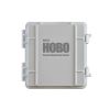
Verification Clip
The optional Verification Clip provides a convenient way to confirm the operation and soil moisture accuracy of HOBOnet T11 and T12 sensors. Attaching this clip to a sensor provides a known soil moisture level for verifying measurement accuracy, without having to test the sensor in actual soils, which normally requires weighing soil samples and drying them in an oven.


Characterized by long-term accumulation under waterlogged conditions, peatlands exist on every continent and account for 3-4% of the global land surface . Small but mighty, these often overlooked wetland environments are estimated to hold as much as one-third of the world's organic carbon in their soil—twice the amount found in the entirety of the Earth's forest biomass. While healthy peatlands can trap and store carbon, regulate water, and provide important habitats for rare species, human alteration has disturbed peatland carbon and nitrogen cycles on a global scale. Approximately 12% of the world’s peatlands have been drained and degraded through conversion for agriculture, forestry, infrastructure development, and other uses.
Read More
Until recently, Sargassum –a free-floating seaweed–was distributed throughout the Sargasso Sea , the north Caribbean Sea, and the Gulf of Mexico. But in the space of a decade, this seaweed has, as one scientist remarks , “Gone from a nonfactor to the source of a terrible crisis.” Driven by climate change, anomalous North Atlantic Oscillation in 2009-2010 and a glut of anthropogenic pollutants, sargassum has proliferated. Seasonally recurrent mats as deep as 7m now bloom in the “Great Atlantic Sargassum Belt” (GASB), which covers areas of the Atlantic from West Africa to the Caribbean Sea and Gulf of Mexico. Every year, millions of tons wash up along the shores of more than 30 countries . Dr.
Read More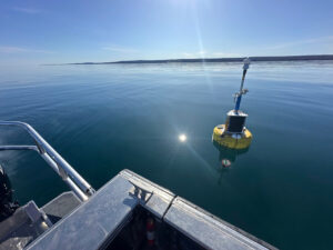
According to the National Oceanic and Atmospheric Administration ( NOAA ), the Great Lakes have more miles of coastline than the contiguous Atlantic and Pacific coasts combined and contain 20 percent of the world's freshwater, making it a critical region to protect and conserve. Continuous monitoring and data-informed resource management are key components of managing waters in the region. Hayden Henderson, a research engineer with the Great Lakes Research Center (GLRC), designs and deploys monitoring platforms throughout the Great Lakes. With a background in environmental engineering, Henderson enjoyed the challenge of creating systems and making them work to obtain difficult, remote measurements.
Read More© 2025 Fondriest Environmental, Inc. | Questions? Call 888.426.2151 or email customercare@fondriest.com