
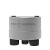
Sequoia LISST-AOBS Super-Turbidity Sensor
Features
- Paired acoustic and optical technologies
- Near-constant calibration within a factor of two for grain-sizes from 1–500 µm
- Includes Y-cable providing power and integrated SDI-12 communication to and from both sensors
- Expedited repair and warranty service
- Lifetime technical support
- More
Overview
The Sequoia LISST-AOBS is a simple, low-cost Super-Turbidity sensor that measures suspended sediment concentration (SSC; mg/l) and turbidity (V). The Sequoia Super-Turbidity sensor involves pairing a LISST-ABS with a turbidity sensor using a weight factor, which results in a single, combined output from the two sensors. Once paired, the LISST-AOBS retains near-constant calibration for SSC over a wide grain-size range.
Connectivity
The LISST-AOBS Super-Turbidity sensor is supplied by Sequoia as an integrated and paired turbidity and acoustic sensor with a variety of cabling and data logger options including the X3 data loggers and telemetry systems. The X3 is available for pole-mount deployments with solar charging or connected to the SBP500 submersible alkaline battery pack for subsurface deployments.
Parameters measured
- Suspended Sediment Concentration (SSC; mg/l)
Concentration range
- 1 – 30,000 mg/l (LISST-ABS)
Technology
- Combined optical and 8MHz acoustic backscatter technology
- Optics per ISO 7027 Turbidity Technique
- Mechanical wiper for optical backscatter
- SDI-12 output
- Sample volume (acoustic): 10mmØ x 15mmL @ 55mm from transducer
Mechanical and electrical
- 5.72 cm (2.25″) H x 10.16 cm (4″) W x 33.65 cm (13.25”) L
- Weight 0.7 kg (1.54 lb) in air
- Transducer: 8 mmØ ceramic
- Wavelength: 850 nm
- Power supply: 9-15 VDC (12VDC nominal); 75 mA
- Depth rating: 100 m
- Material: ABS plastic and Delrin
- (1) LISST-ABS acoustic sediment sensor
- (1) Turbidity Plus turbidity sensor
- (1) LISST-AOBS Y-cable
- (1) LISST-AOBS connecting bracket
Select Options


In The News

Sargassum Surge: How Seaweed is Transforming our Oceans and Coastal Ecosystems
Until recently, Sargassum –a free-floating seaweed–was distributed throughout the Sargasso Sea , the north Caribbean Sea, and the Gulf of Mexico. But in the space of a decade, this seaweed has, as one scientist remarks , “Gone from a nonfactor to the source of a terrible crisis.” Driven by climate change, anomalous North Atlantic Oscillation in 2009-2010 and a glut of anthropogenic pollutants, sargassum has proliferated. Seasonally recurrent mats as deep as 7m now bloom in the “Great Atlantic Sargassum Belt” (GASB), which covers areas of the Atlantic from West Africa to the Caribbean Sea and Gulf of Mexico. Every year, millions of tons wash up along the shores of more than 30 countries . Dr.
Read More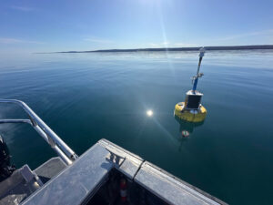
Great Lakes Research Center: Designing Targeted Monitoring Solutions
According to the National Oceanic and Atmospheric Administration ( NOAA ), the Great Lakes have more miles of coastline than the contiguous Atlantic and Pacific coasts combined and contain 20 percent of the world's freshwater, making it a critical region to protect and conserve. Continuous monitoring and data-informed resource management are key components of managing waters in the region. Hayden Henderson, a research engineer with the Great Lakes Research Center (GLRC), designs and deploys monitoring platforms throughout the Great Lakes. With a background in environmental engineering, Henderson enjoyed the challenge of creating systems and making them work to obtain difficult, remote measurements.
Read More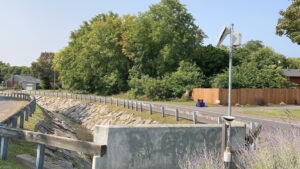
Monitoring Meadowbrook Creek: Real-Time Data Collection in an Urban Creek
Meadowbrook Creek in Syracuse, New York, has been monitored by Syracuse University (SU) faculty and students for over a decade. Originally established by Dr. Laura Lautz in 2012, the early years of the program focused on collecting grab water samples for laboratory analysis and evaluating the impact of urban land use, human activities, and natural processes on water resources. Tao Wen , an Assistant Professor in SU’s Department of Earth and Environmental Sciences, took over the program in 2020 and upgraded the existing systems to include 4G modems that allowed for real-time data viewing. [caption id="attachment_39339" align="alignnone" width="940"] An overview of the Fellows Ave monitoring station along Meadowbrook Creek.
Read More