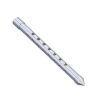
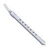
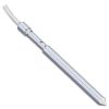
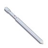
Solinst Model 615 Drive-Point Piezometer
Features
- Affordable method to monitor shallow groundwater and soil vapor
- Attach to inexpensive 3/4" (20 mm) NPT steel drive pipe
- Can be used for permanent well points or short-term monitoring applications
- Expedited repair and warranty service
- Lifetime technical support
- More
Overview
The Solinst Model 615 Drive-Point Piezometer uses a high quality stainless steel piezometer tip, 3/4" NPT pipe for drive extensions and LDPE or Teflon sample tubing, if desired. Combine these with an inexpensive Slide Hammer and you have a complete system.
Design
The Solinst Model 615 Drive-Point Piezometer has a stainless steel, 50 mesh cylindrical filter-screen, within a 3/4" (20 mm) stainless steel drive-point body, screen support and a barbed fitting for attachment of sample tubing. Optional heavy-duty extension couplings are also available to create a strengthened and more rugged piezometer.
The inner barbed fitting allows connection of 5/8" OD x 1/2" ID (16 mm x 12 mm) LDPE or Teflon sample tubing. This prevents sample water from contacting the steel extension rods, and maintains high sample integrity, even when inexpensive carbon steel extensions are used.
In The News
New map shows significant groundwater depletion in Central California
Groundwater level data collected by a Central California county shows significant drops during the past 12 years, according to a San Luis Obispo Tribune article. Data shows that groundwater has dropped by a minimum of 70 feet from 1997 to 2009 in the Paso Robles area of Central California. In the past four years the areas of most significant decline have expanded north and south. Drought and agricultural withdrawals are the likely culprits for the groundwater decline. Some advocates are calling for more responsible water use by vineyards in the area, while farmers note that the recent drought did not help the situation.
Read MoreSupplying Seattle’s Drinking Water: Using Data Buoys to Monitor the Cedar River Municipal Watershed
Providing clean, safe, and reliable drinking water for the 1.6 million people in the greater Seattle area is a top priority for Seattle Public Utilities (SPU). With limited water supplies, SPU dedicates considerable resources to maintain its watersheds and mountain reservoirs. About 70 percent of Seattle Water comes from the Cedar River Municipal Watershed , and the other 30 percent comes from the South Fork Tolt River Watershed . [caption id="attachment_39574" align="alignnone" width="940"] Data buoy in Chester Morse Lake . (Credit: Kevin Johnson / Seattle Public Utilities) [/caption] Jamie Thompson, a fisheries biologist at SPU, monitors aquatic ecosystems centered on fish listed under the U.S. Endangered Species Act (ESA).
Read MoreData-Driven Advocacy on the Lower Deschutes River
Like many freshwater environments, the Deschutes River in Oregon is under pressure from development, pollution, and climate change. Many rivers, streams and lakes in the Deschutes Basin do not meet Oregon water quality standards –where state water quality monitoring assesses levels of bacteria, pH, dissolved oxygen, temperature, and fine sediment. Hannah Camel is the Water Quality Coordinator for the Deschutes River Alliance (DRA), a non-profit organization that focuses on the health of the lower 100 miles of the Deschutes River–the area most affected by human intervention. As a data-driven organization, the DRA has benefited from the installation of two NexSens X2 data loggers.
Read More


