My Cart
You have no items in your shopping cart.
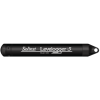
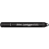
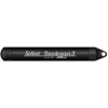
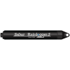
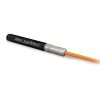
The Solinst Readout Unit (SRU) is a field-ready device designed to take and display instant water level readings from a deployed Solinst datalogger, as well as allow the simple download of stored data.
Overview
The Solinst Readout Unit (SRU) is an in-field device designed to take and display instant water level readings from a deployed Solinst datalogger. When connected, users can select a real-time sampling rate and start a real-time monitoring session independent of the datalogger’s internal logging mode.
Real-Time Data
Real-time logs can be saved in the SRU memory. The SRU has an internal barometer, which provides the option of showing and saving real-time water level readings corrected to ambient air pressure. The SRU also functions as a data download and storage device with a robust flash memory. Saved files can be trasnferred to a PC. The SRU allows users to access information about the connected datalogger’s status, including battery level, memory, serial number, firmware version, and logging mode, as well as the SRU status.
Connections
The SRU connects to a Levelogger’s Direct Read Cable, a LevelVent Wellhead, or AquaVent Wellhead connector cable. The LCD screen contrast is adjustable to ensure easy viewing in any field condition. To transfer data files to a PC, the SRU connects using a USB cable. Levelogger Software is used to download, view, export, delete data and set up dataloggers. Through the Software, the SRU has upgradable firmware, which allows for future improvements and compatibility with new dataloggers.


Characterized by long-term accumulation under waterlogged conditions, peatlands exist on every continent and account for 3-4% of the global land surface . Small but mighty, these often overlooked wetland environments are estimated to hold as much as one-third of the world's organic carbon in their soil—twice the amount found in the entirety of the Earth's forest biomass. While healthy peatlands can trap and store carbon, regulate water, and provide important habitats for rare species, human alteration has disturbed peatland carbon and nitrogen cycles on a global scale. Approximately 12% of the world’s peatlands have been drained and degraded through conversion for agriculture, forestry, infrastructure development, and other uses.
Read More
Until recently, Sargassum –a free-floating seaweed–was distributed throughout the Sargasso Sea , the north Caribbean Sea, and the Gulf of Mexico. But in the space of a decade, this seaweed has, as one scientist remarks , “Gone from a nonfactor to the source of a terrible crisis.” Driven by climate change, anomalous North Atlantic Oscillation in 2009-2010 and a glut of anthropogenic pollutants, sargassum has proliferated. Seasonally recurrent mats as deep as 7m now bloom in the “Great Atlantic Sargassum Belt” (GASB), which covers areas of the Atlantic from West Africa to the Caribbean Sea and Gulf of Mexico. Every year, millions of tons wash up along the shores of more than 30 countries . Dr.
Read More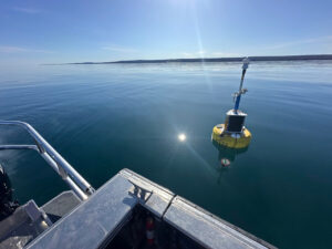
According to the National Oceanic and Atmospheric Administration ( NOAA ), the Great Lakes have more miles of coastline than the contiguous Atlantic and Pacific coasts combined and contain 20 percent of the world's freshwater, making it a critical region to protect and conserve. Continuous monitoring and data-informed resource management are key components of managing waters in the region. Hayden Henderson, a research engineer with the Great Lakes Research Center (GLRC), designs and deploys monitoring platforms throughout the Great Lakes. With a background in environmental engineering, Henderson enjoyed the challenge of creating systems and making them work to obtain difficult, remote measurements.
Read More© 2025 Fondriest Environmental, Inc. | Questions? Call 888.426.2151 or email customercare@fondriest.com