
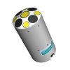
SonTek RiverSurveyor Power & Communications Modules
Features
- Powered by (16) AA alkaline batteries
- Includes 1m cable for connection to S5/M9
- Optional differential or RTK GPS for collecting position data
- Expedited repair and warranty service
- Lifetime technical support
- More
Radio Frequency: 2.4 GHz
- Optional Bridge interface module will provide a Bluetooth interface between the 2.4 GHz radio in the PCM and a computer or tablet.
Batteries:
- Type: Standard AA batteries1
- Average duration: 8 hours of continuous operation (6 hours with RTK GPS enabled)
GPS Options:
- SBAS GPS Horizontal Accuracy2: <1.0m
- RTK GPS Horizontal Accuracy2: <0.02m ; Vertical Accuracy <0.04m2,3
| Range (Std.; 10 dBm)4 | Range (High; 22dBm)4 | |
| Base to Rover | 1000 m | 3000 m |
| PC to Rover | 450 m | 1500 m |
| Bridge to Rover | 200 m | 400 m |
1Standard AA batteries are defined as alkaline or NiMH rechargeables, with a diameter up to 14.5mm.
2Depends on multipath environment, antenna selection, number of satellites in view, satellite geometry, and ionospheric activity.
3Requires absolute RTK solution. Only available with HydroSurveyor
4High power may not be available in all countries; all ranges with default 2 dBi antenna and line-of-sight.
Select Options


In The News

Supplying Seattle’s Drinking Water: Using Data Buoys to Monitor the Cedar River Municipal Watershed
Providing clean, safe, and reliable drinking water for the 1.6 million people in the greater Seattle area is a top priority for Seattle Public Utilities (SPU). With limited water supplies, SPU dedicates considerable resources to maintain its watersheds and mountain reservoirs. About 70 percent of Seattle Water comes from the Cedar River Municipal Watershed , and the other 30 percent comes from the South Fork Tolt River Watershed . [caption id="attachment_39574" align="alignnone" width="940"] Data buoy in Chester Morse Lake. Data buoy in Masonry Pool. (Credit: Kevin Johnson / Seattle Public Utilities) [/caption] Jamie Thompson, a fisheries biologist at SPU, monitors aquatic ecosystems centered on fish listed under the U.S. Endangered Species Act (ESA).
Read More
Data-Driven Advocacy on the Lower Deschutes River
Like many freshwater environments, the Deschutes River in Oregon is under pressure from development, pollution, and climate change. Many rivers, streams and lakes in the Deschutes Basin do not meet Oregon water quality standards –where state water quality monitoring assesses levels of bacteria, pH, dissolved oxygen, temperature, and fine sediment. Hannah Camel is the Water Quality Coordinator for the Deschutes River Alliance (DRA), a non-profit organization that focuses on the health of the lower 100 miles of the Deschutes River–the area most affected by human intervention. As a data-driven organization, the DRA has benefited from the installation of two NexSens X2 data loggers.
Read More
Expanding the Port Everglades: Real-Time Monitoring of Water Quality Conditions from Planned Dredging Operation
The Port Everglades in Broward County, Florida, serves large trade vessels and cruiseliners and incoming and outgoing recreational boaters. However, as cargo ships become larger, the port must expand. A dredging project led by the US Army Corps of Engineers will substantially deepen and widen the port's navigation channel to accommodate larger Panamax cargo ships and modern cruise liners. As a result of this project, a large amount of sediment will be displaced into the water column. This suspended sediment may settle outside of the project area, burying benthic organisms like corals, and possibly carrying harmful particulates to other regions. [caption id="attachment_39497" align="aligncenter" width="2560"] A CB-950 and CB-25 deployed on site at Port Everglades.
Read More