
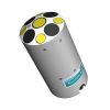
SonTek RS5 Acoustic Doppler Current Profiler
Features
- SmartPulse+ utilizes Pulse-coherent and Broadband acoustic profiling that automatically adjusts based on conditions
- Vertical acoustic beam for the most accurate channel cross-sectional area in discharge applications
- Batteries and Bluetooth radio are housed in the RS5, eliminating external electric boxes
- Expedited repair and warranty service
- Lifetime technical support
- More
Overview
The HydroSurveyor is a system designed to collect bathymetric, water column velocity profile, and acoustic bottom tracking data as part of a hydrographic survey. The two key components of the system are the HydroSurveyor Acoustic Doppler Profiler (ADP) platform, and the powerful, yet user-friendly, data collection software. With the HydroSurveyor platform, SonTek is able to offer an exclusive 5-beam depth sounding device, with built-in navigation, full water column velocity (currents) profiling, full compensation for speed of sound (with the CastAway-CTD), and integrated positioning solution.
| Water Velocity Profiling | Profiling Range | 0.1-6 m (*1) |
| Velocity Range | ±5 m/s | |
| Accuracy | 1% ±0.002 m/s | |
| Resolution | 0.001 m/s | |
| Number of Cells | Up to 128 | |
| Cell Size | 2.5-30 cm | |
| Data Output Rate | 1.0 Hz | |
| Bottom Tracking | Depth Range | 0.1-6 m (*1) |
| Accuracy (*2) | 1% ± 0.002 m/s | |
| Resolution | 0.001 m/s | |
| Depth Measurement | Range | 0.1-6.5 m (*1) |
| Accuracy | 1% ±0.005 m | |
| Sensors | Temperature Sensors | Resolution: ±0.01°C Accuracy: ±0.5°C |
| Compass/Tilt Sensor | Range: ±180° Pitch/Roll, 0-360° Heading Heading Accuracy: ±2° Pitch/Roll Accuracy: ±1° |
|
| Transducers | Total Number | Five, 3.0 Mhz |
| Beam Angle | 25° | |
| Beam Width | 3° | |
| Bandwidth | 25% | |
| Battery Characteristics | Input Voltage | 3.3-4.2 VDC |
| Power Source - Li-Ion | 1x size 18650, Tenergy, Type 30016-04, 3.7Vdc, 2600mAh | |
| Battery Life - 1 x size 18650 | Seven hours continuous use, typical settings (*3) | |
| Power Consumption | 1.0 W (Average) | |
| Dimensions | 19.2 mm x 69.7 mm | |
| Communications | Radio Protocol | Bluetooth Low Energy (BLE5) |
| Range | 100 m (*4) | |
| Bluetooth Compliance | FCC Part 15, FCC ID: XPYNINAB30 ISED Certification: 8595A-NINAB30 |
|
| Environmental | Operation Temperature | -5° to 45°C (23°F to 113°F) |
| Storage Temperature | -20° to 70°C (-4°F to 158°F) | |
| Storage with Battery Temperature (*5) | -20° to 45°C (-4°F to 113°F) | |
| RS5 Physical Properties | Dimensions - HBII Micro | 76 cm (30”) x 50 cm (20”) x 11cm (4.25”) |
| Dimensions - RS5 Unit | 24 cm (9.5”) x 5 cm (2.2”) | |
| Weight in Air - RS5 Unit | 0.45 kg (1.0 lbs) | |
| Weight in Water - RS5 Unit | 0.15 kg (0.33 lbs) | |
| Weight in Air - RS5/HBII Micro/Geode | 3.63 kg (8.0 lbs) | |
| Waterproof Rating | IP67 | |
| DGNSS | Horizontal RMS | SBAS (WAAS): <0.3 m (0.98 ft) |
| 2DRMS | SBAS (WAAS): <0.6 m (1.96 ft) | |
| Frequency | L1, Multi-GNSS |
*Additional notes
1 Maximum range will vary with environmental conditions.
2 Bottom velocity accuracy.
3 Seven hours continuous use, typical settings.
4 When using provided SonTek USB radio with antenna.
5 Remove batteries from the RS5 if storage temperatures exceed the storage temperature of the Li-Ion battery.
- RS5 acoustic Doppler current profiler
- RSQ Windows software
- Plastic shipping case
- 3‐ft (91‐cm) radio antenna cable
- USB Bluetooth radio
- (2) Li‐Ion rechargeable batteries
- USB battery charger
Select Options


In The News

Supplying Seattle’s Drinking Water: Using Data Buoys to Monitor the Cedar River Municipal Watershed
Providing clean, safe, and reliable drinking water for the 1.6 million people in the greater Seattle area is a top priority for Seattle Public Utilities (SPU). With limited water supplies, SPU dedicates considerable resources to maintain its watersheds and mountain reservoirs. About 70 percent of Seattle Water comes from the Cedar River Municipal Watershed , and the other 30 percent comes from the South Fork Tolt River Watershed . [caption id="attachment_39574" align="alignnone" width="940"] Data buoy in Chester Morse Lake . (Credit: Kevin Johnson / Seattle Public Utilities) [/caption] Jamie Thompson, a fisheries biologist at SPU, monitors aquatic ecosystems centered on fish listed under the U.S. Endangered Species Act (ESA).
Read More
Data-Driven Advocacy on the Lower Deschutes River
Like many freshwater environments, the Deschutes River in Oregon is under pressure from development, pollution, and climate change. Many rivers, streams and lakes in the Deschutes Basin do not meet Oregon water quality standards –where state water quality monitoring assesses levels of bacteria, pH, dissolved oxygen, temperature, and fine sediment. Hannah Camel is the Water Quality Coordinator for the Deschutes River Alliance (DRA), a non-profit organization that focuses on the health of the lower 100 miles of the Deschutes River–the area most affected by human intervention. As a data-driven organization, the DRA has benefited from the installation of two NexSens X2 data loggers.
Read More
Expanding the Port Everglades: Real-Time Monitoring of Water Quality Conditions from Planned Dredging Operation
The Port Everglades in Broward County, Florida, serves large trade vessels and cruiseliners and incoming and outgoing recreational boaters. However, as cargo ships become larger, the port must expand. A dredging project led by the US Army Corps of Engineers will substantially deepen and widen the port's navigation channel to accommodate larger Panamax cargo ships and modern cruise liners. As a result of this project, a large amount of sediment will be displaced into the water column. This suspended sediment may settle outside of the project area, burying benthic organisms like corals, and possibly carrying harmful particulates to other regions. [caption id="attachment_39497" align="aligncenter" width="2560"] A CB-950 and CB-25 deployed on site at Port Everglades.
Read More