
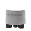
SonTek-SL Series Side-Looking Doppler Current Meters
Features
- Accurate & reliable water velocity, level, & discharge measurements
- Measurements are made in a remote sampling volume free from flow distortion
- 3G model offers 128-cells for high-resolution and detailed profiles
- Expedited repair and warranty service
- Lifetime technical support
- More
Overview
The SonTek-SL (affectionately known as the Side-Looker or "SL") has earned worldwide acceptance as a long-term monitoring solution. Now, with two new (3G) models turbo-charged by the proprietary SmartPulseHD, the SonTek-SL features accessories, mounting options, software, and a variety of integration formats to ensure it fits the desired application.
Design
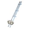
Designed specifically for side mounting on bridges, canal walls, or riverbanks, the SL's sleek, low-profile housing makes installation easy. With three models to choose from, the SL can be used in wide or narrow channels. Ultra narrow beam widths combined with unmatched side lobe suppression provide the superior acoustic directivity necessary for achieving maximum horizontal range free of interference from surface or bottom boundaries.
Mechanics
First time users can collect test data within minutes of receiving the SonTek-SL. Deployments require only a few minutes to configure the SL and start collecting data. This system provides the highest quality Doppler velocity data without requiring the user to become an expert on Doppler technology.
Benefits
- SmartPulseHD (3G models only): An intelligent algorithm that looks at water depth, profiling range, velocity, and turbulence, and then acoustically adapts to those conditions using pulse-coherent, broadband, and incoherent techniques. Best data possible under any condition. High-def cell sizes down to 4 cm.
- Compact, Hydrodynamic Design: Incredibly lightweight and easy to transport and mount. Slim shape is easy to maintain, stays clean, increases available sample area, and fits into more places.
- Water Velocity Profiling: Customizeable, flexible setup options to suit a variety of applications. 3G models offer 128-cells for high-resolution and detailed profiles.
- Acoustic-Pressure "Duo" Water Level (3G models only): Not only redundant sources of water level, the acoustic vertical beam and pressure sensor continually self-check, and pressure data are auto-corrected to keep atmospheric offset negligible.
- Versatile, Easy Mounting: Easy-access side mounting reduces concerns over personnel safety, lowers operational cost by avoiding divers and boats, avoids interruption in facility operations, and avoids interruption in data and water delivery to clients and stakeholders.
- Wave Spectra Option: Integrated pressure sensor calculates and outputs wave-height and period, in real-time.
Select Options


In The News

Supplying Seattle’s Drinking Water: Using Data Buoys to Monitor the Cedar River Municipal Watershed
Providing clean, safe, and reliable drinking water for the 1.6 million people in the greater Seattle area is a top priority for Seattle Public Utilities (SPU). With limited water supplies, SPU dedicates considerable resources to maintain its watersheds and mountain reservoirs. About 70 percent of Seattle Water comes from the Cedar River Municipal Watershed , and the other 30 percent comes from the South Fork Tolt River Watershed . [caption id="attachment_39574" align="alignnone" width="940"] Data buoy in Chester Morse Lake. Data buoy in Masonry Pool. (Credit: Kevin Johnson / Seattle Public Utilities) [/caption] Jamie Thompson, a fisheries biologist at SPU, monitors aquatic ecosystems centered on fish listed under the U.S. Endangered Species Act (ESA).
Read More
Data-Driven Advocacy on the Lower Deschutes River
Like many freshwater environments, the Deschutes River in Oregon is under pressure from development, pollution, and climate change. Many rivers, streams and lakes in the Deschutes Basin do not meet Oregon water quality standards –where state water quality monitoring assesses levels of bacteria, pH, dissolved oxygen, temperature, and fine sediment. Hannah Camel is the Water Quality Coordinator for the Deschutes River Alliance (DRA), a non-profit organization that focuses on the health of the lower 100 miles of the Deschutes River–the area most affected by human intervention. As a data-driven organization, the DRA has benefited from the installation of two NexSens X2 data loggers.
Read More
Expanding the Port Everglades: Real-Time Monitoring of Water Quality Conditions from Planned Dredging Operation
The Port Everglades in Broward County, Florida, serves large trade vessels and cruiseliners and incoming and outgoing recreational boaters. However, as cargo ships become larger, the port must expand. A dredging project led by the US Army Corps of Engineers will substantially deepen and widen the port's navigation channel to accommodate larger Panamax cargo ships and modern cruise liners. As a result of this project, a large amount of sediment will be displaced into the water column. This suspended sediment may settle outside of the project area, burying benthic organisms like corals, and possibly carrying harmful particulates to other regions. [caption id="attachment_39497" align="aligncenter" width="2560"] A CB-950 and CB-25 deployed on site at Port Everglades.
Read More