
YOUNG Tipping Bucket Rain Gauges
Features
- Uses a proven tipping bucket mechanism
- Bucket geometry & material are specially selected for maximum water release
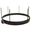
- Optional bird ring assembly to prevent interference
- Free ground shipping
- Expedited repair and warranty service
- Lifetime technical support
- More
Overview
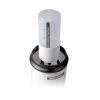
The YOUNG RM Young tipping-bucket rain gauges use an established tipping bucket mechanism for effective rainfall measurement. The bucket geometry and material of this rain gauge are specially selected for maximum water release, thereby reducing contamination and errors. A catchment area of 200cm2 and measurement resolution of 0.1mm meet the recommendations of the World Meteorological Organization (WMO).
Mechanics
Extensive use of molded thermoplastic components ensures maximum performance and value. Leveling screws and bullseye level are built-in for easy and precise adjustment in the field. Measured precipitation is discharged through a collection tube for verification of total rainfall. Model 52203 is an unheated model for use in moderate climates. For colder climates, model 52202 uses a heating element to prevent freezing. A bird ring option is also available to prevent birds from clogging up the rain gauge.
- Size: 18 cm dia. x 30 cm high, (39 cm high with mounting base)
- Catchment Area: 200 cm2
- Resolution: 0.1 mm per tip
- Accuracy: 2% up to 25 mm/hr; 3% up to 50 mm/hr
- Output: Magnetic reed switch (N.O.), rating 24VAC/DC 500mA
- Mounting: Clamp for 1" (1.34" dia.) iron pipe or 3 bolts on 160mm dia. circle
- Other: Leveling adjustment, thermostatic control for heater, intake screen
- (1) Tipping-bucket rain gauge
- (1) Clamp for 1" (1.34" dia.) pipe
Select Options


In The News

UNC's industry-standard water quality profiling platforms get upgrade
The University of North Carolina Institute Of Marine Sciences has a history with profiling platforms. UNC engineers and scientists have been building the research floaters for 10 years in a lab run by in Rick Luettich, director of the institute. UNC scientists and engineers developed their own autonomous vertical profilers to take water quality readings throughout the water column. They have three profilers placed in the New and Neuse rivers. The profilers are designed to drop a payload of sensors to an allotted depth at set time intervals. Instruments attached take readings continuously on the way down and up. Data collected by the profilers has been used to study water related issues such as infectious disease and sediment suspension.
Read More
USGS weather station network monitors Arctic Alaska's climate
When the U.S. Geological Survey began building their climate and permafrost monitoring network in Arctic Alaska in 1998, there wasn't much precedent for how to build the infrastructure for the instruments in the region's unforgiving environment. That meant the scientists had to learn the particulars on the fly. For example: On the great expanse of flat, barren tundra, a weather station sticks out like a sore thumb to a curious grizzly bear. "The initial stations were pretty fragile," said Frank Urban, a geologist with the USGS Geosciences and Environmental Change Science Center. "So the bear and those stations--the bear won every single time without any problem.
Read More
Spring 2025 Environmental Monitor Available Now
In the Spring 2025 edition of the Environmental Monitor, we highlight partnerships across the world and the importance of collaboration between government agencies, universities, environmental groups, local communities, and other stakeholders. From great white shark research in Cape Cod to monitoring fisheries in Lake Erie, this latest edition underscores partnerships that connect stakeholders in a watershed through environmental data. With an emphasis on data sharing, a combination of real-time and discrete sampling keeps the public and partners informed of environmental conditions. Our writers also sought out science professionals dedicated to working with peers within and outside of the environmental sector.
Read More