
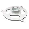
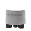
YSI H-3401 Tipping Bucket Rain Gauge
Features
- Two removable stainless steel funnel screens
- Rustproof, powder painted aluminum enclosure and cast base
- Built in microprocessor automatically corrects errors
- Expedited repair and warranty service
- Lifetime technical support
- More
Overview
The YSI H-3401 is a precision tipping bucket rain gauge with SDI-12 output for use in hydro-meteorological applications. The SDI-12 feature converts a standard tipping bucket rain gauge into a “smart” SDI-12 sensor with additional capabilities.
Output Data Parameters
- Accumulated rainfall since last measurement
- Raw bucket count since last measurement
- Total accumulation
- Total daily accumulation (today)
- Total daily accumulation (yesterday)
Easy Integration
The H-3401 is easy to use and works with any data logger with SDI-12 input. It scales the bucket tips into units (inches, meters, etc.) and provides a built-in accumulation of daily and total rainfall. The unit also provides mathematical correction for bucket volume errors due to varying rainfall rate.
| Connectivity / Communications | SDI-Output. Baud Rate: 1200; Protocol: SDI-12, version 1.3; Output voltage levels: Min High level: 3.5 volts, Max low level: 0.8 volts, Max cable length: 250 ft (76 m) |
|---|---|
| Connector | Screw Clamp, for #12-22 AWG wire |
| Operating Temperature | Electronic: -40 ° to +60 ° C; Mechanical: 0 ° to +50 ° C |
| Power | Power Requirements: Voltage Input 10.0 to 16.0 volts DC Standby: 180µA typical; Current Raining: 2.8 mA for 60 seconds Communication: 6 mA |
| Storage Temperature | -50 ° to +70 ° C |
| Mounting | Three anodized aluminum external mounting feet with 0.281" holes |
| Warranty |
2 years |
Select Options


In The News

Spring 2025 Environmental Monitor Available Now
In the Spring 2025 edition of the Environmental Monitor, we highlight partnerships across the world and the importance of collaboration between government agencies, universities, environmental groups, local communities, and other stakeholders. From great white shark research in Cape Cod to monitoring fisheries in Lake Erie, this latest edition underscores partnerships that connect stakeholders in a watershed through environmental data. With an emphasis on data sharing, a combination of real-time and discrete sampling keeps the public and partners informed of environmental conditions. Our writers also sought out science professionals dedicated to working with peers within and outside of the environmental sector.
Read More
Monitoring Mariculture in the Gulf of Alaska
The mariculture industry in the Gulf of Alaska has been steadily growing in recent years, guided by ongoing research to help refine farm location and cultivation practices. A subset of aquaculture, mariculture focuses on rearing organisms in the open ocean. In Alaska, finfish farming is illegal, so most farms cultivate kelp, oysters, or a combination of the two. These small, locally operated farms started popping up in the Gulf of Alaska in the early 1990s, when shellfish farming first became legal. Kelp farming did not begin to catch on in the state until 2016. Many of the coastal areas that have grown interested in mariculture are historically commercial fishing communities.
Read More
Supplying Seattle’s Drinking Water: Using Data Buoys to Monitor the Cedar River Municipal Watershed
Providing clean, safe, and reliable drinking water for the 1.6 million people in the greater Seattle area is a top priority for Seattle Public Utilities (SPU). With limited water supplies, SPU dedicates considerable resources to maintain its watersheds and mountain reservoirs. About 70 percent of Seattle Water comes from the Cedar River Municipal Watershed , and the other 30 percent comes from the South Fork Tolt River Watershed . [caption id="attachment_39574" align="alignnone" width="940"] Data buoy in Chester Morse Lake . (Credit: Kevin Johnson / Seattle Public Utilities) [/caption] Jamie Thompson, a fisheries biologist at SPU, monitors aquatic ecosystems centered on fish listed under the U.S. Endangered Species Act (ESA).
Read More