
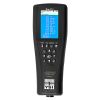
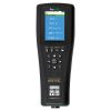
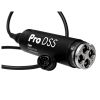
YSI ProDSS Turbidity Sensor
Features
- 0 to 4000 FNU measurement range
- T63<2 sec response time
- 0.3 FNU or ±2% of reading accuracy from 0 to 999 FNU
- Free ground shipping
- Expedited repair and warranty service
- Lifetime technical support
- More
Overview
The ProDSS turbidity sensor is a digital smart sensor featuring welded titanium construction for use with the ProDIGITAL family of instruments. Compatible instruments include the ProDSS Meter, ProSwap Meter, and ProSwap Logger.
Mechanics
Turbidity is the indirect measurement of the suspended solid concentration in water and is typically determined by shining a light beam into the sample solution and then measuring the light that is scattered off of the particles which are present. The suspended solid concentration is an important water quality factor and is a fundamental measure of environmental change. The source of the suspended solids varies in nature (examples include silt, clay, sand, algae and organic matter), but all particles will impact the light transmittance and result in a turbidity signal.
Customizable
The ProDSS Turbidity sensor employs a near-infrared light source and detects scattering at 90 degrees of the incident light beam. According to ASTM D7315 method, this type of turbidity sensor has been characterized as a nephelometric near-IR turbidimeter, non-ratiometric. This method calls for this sensor type to report values in formazin nephelometric units (FNU). FNU is the default calibration unit for the ProDSS sensor, but users are able to change calibration units to nephelometric turbidity units (NTU), raw sensor signal (RAW), or total suspended solids (TSS).
ProDSS Smart Sensor Specifications:
| Parameter |
Range | Accuracy* | Resolution |
|---|---|---|---|
|
Conductivity |
0 to 200 mS/cm |
From 100 to 200 mS/cm: ± 1% |
**0.001, 0.01 or 0.1 µS/cm |
|
Temperature |
-5 to 70 °C |
± 0.2 °C |
0.1 °C or 0.1 °F |
| Dissolved Oxygen |
0 to 50 mg/L |
From 0 to 20 mg/L: ± 1% From 20 to 50 mg/L: ± 8% |
0.01 mg/L or 0.1 mg/L |
| pH |
0 to 14 |
± 0.2 |
0.01 |
|
ORP |
-1999 to 1999 mV |
± 20 mV |
0.1 mV |
| Turbidity |
0 to 4000 FNU |
From 0 to 999 FNU: ± 2% From 1000 to 4000 FNU: ± 5% |
0.1 FNU |
| Freshwater Total Algae |
0 to 100 µg/L PC |
r2 = 0.999 |
0.01 µg/L PC |
| Saltwater Total Algae |
0 to 280 µg/L PE |
r2 = 0.999 |
0.01 µg/L PE |
| Nitrate |
0 to 200 mg/L |
± 10% |
0.01 mg/L |
| Ammonium |
0 to 200 mg/L |
± 10% |
0.01 mg/L |
| Chloride |
0 to 1000 mg/L Cl |
± 15% |
0.01 mg/L |
*Reference specification for each sensor for more details on accuracy
** Range dependent
Select Options


In The News

Supplying Seattle’s Drinking Water: Using Data Buoys to Monitor the Cedar River Municipal Watershed
Providing clean, safe, and reliable drinking water for the 1.6 million people in the greater Seattle area is a top priority for Seattle Public Utilities (SPU). With limited water supplies, SPU dedicates considerable resources to maintain its watersheds and mountain reservoirs. About 70 percent of Seattle Water comes from the Cedar River Municipal Watershed , and the other 30 percent comes from the South Fork Tolt River Watershed . [caption id="attachment_39574" align="alignnone" width="940"] Data buoy in Chester Morse Lake . (Credit: Kevin Johnson / Seattle Public Utilities) [/caption] Jamie Thompson, a fisheries biologist at SPU, monitors aquatic ecosystems centered on fish listed under the U.S. Endangered Species Act (ESA).
Read More
Data-Driven Advocacy on the Lower Deschutes River
Like many freshwater environments, the Deschutes River in Oregon is under pressure from development, pollution, and climate change. Many rivers, streams and lakes in the Deschutes Basin do not meet Oregon water quality standards –where state water quality monitoring assesses levels of bacteria, pH, dissolved oxygen, temperature, and fine sediment. Hannah Camel is the Water Quality Coordinator for the Deschutes River Alliance (DRA), a non-profit organization that focuses on the health of the lower 100 miles of the Deschutes River–the area most affected by human intervention. As a data-driven organization, the DRA has benefited from the installation of two NexSens X2 data loggers.
Read More
Expanding the Port Everglades: Real-Time Monitoring of Water Quality Conditions from Planned Dredging Operation
The Port Everglades in Broward County, Florida, serves large trade vessels and cruiseliners and incoming and outgoing recreational boaters. However, as cargo ships become larger, the port must expand. A dredging project led by the US Army Corps of Engineers will substantially deepen and widen the port's navigation channel to accommodate larger Panamax cargo ships and modern cruise liners. As a result of this project, a large amount of sediment will be displaced into the water column. This suspended sediment may settle outside of the project area, burying benthic organisms like corals, and possibly carrying harmful particulates to other regions. [caption id="attachment_39497" align="aligncenter" width="2560"] A CB-950 and CB-25 deployed on site at Port Everglades.
Read More